Approximate Location Map
Large Map »
Latitude: 53.9048 / 53°54'17"N
Longitude: -1.6944 / 1°41'39"W
OS Eastings: 420175
OS Northings: 445444
OS Grid: SE201454
Mapcode National: GBR JRL8.ZZ
Mapcode Global: WHC8X.Y39V
Plus Code: 9C5WW834+W6
Entry Name: Whitakers Arms Public House
Listing Date: 8 July 1974
Grade: II
Source: Historic England
Source ID: 1135239
English Heritage Legacy ID: 341447
ID on this website: 101135239
Location: Otley, Leeds, West Yorkshire, LS21
County: Leeds
Civil Parish: Otley
Built-Up Area: Otley
Traditional County: Yorkshire
Lieutenancy Area (Ceremonial County): West Yorkshire
Church of England Parish: Otley All Saints
Church of England Diocese: Leeds
Tagged with: Pub
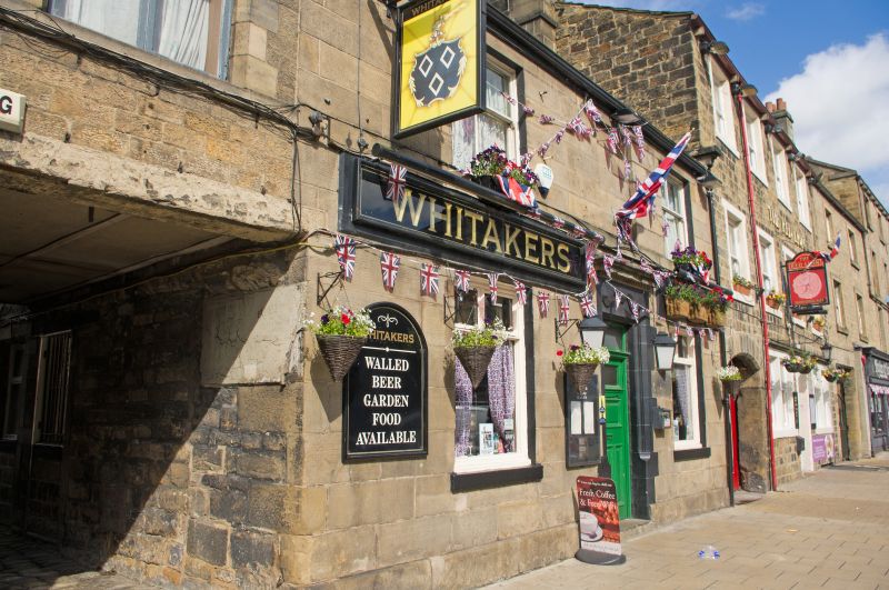
Kirkgate
1.
1480
(West Side)
No 45 (Whitakers Arms
Public House)
SE 2045 1/191
II GV
2.
Early-mid C19. Two storeys in stone with stone slate roof with stone
stacks at gable ends. Three windows, one blocked, no glazing bars. Carved
doorway with splayed reveals, panelled door. Included as part of a group.
Nos 33 to 45 (odd) form a group.
No. 45 also forms a group with Nos 59 and 61.
Listing NGR: SE2017745442
External links are from the relevant listing authority and, where applicable, Wikidata. Wikidata IDs may be related buildings as well as this specific building. If you want to add or update a link, you will need to do so by editing the Wikidata entry.


Other nearby listed buildings
