Approximate Location Map
Large Map »
Latitude: 53.5905 / 53°35'25"N
Longitude: -1.7501 / 1°45'0"W
OS Eastings: 416638
OS Northings: 410462
OS Grid: SE166104
Mapcode National: GBR JV6X.XN
Mapcode Global: WHCBG.20WS
Plus Code: 9C5WH6RX+5X
Entry Name: 54, the Village
Listing Date: 16 May 1984
Grade: II
Source: Historic England
Source ID: 1135354
English Heritage Legacy ID: 341241
ID on this website: 101135354
SE 11 SE
5/125
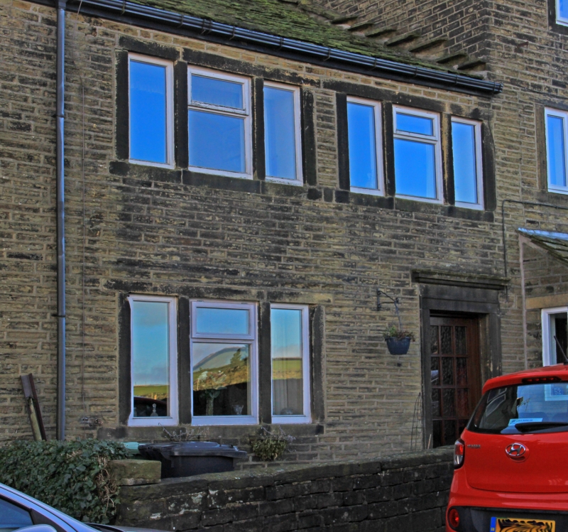
THE VILLAGE
Thurstonland
No. 54
G.V.
II
House, part of row, Early C19. Hammer dressed stone. Stone slate
roof with recent brick stack. Two storeys. Entrance to right with
frieze and small cornice. One 3-light window to left and two 3-light
windows to 1st floor.
Listing NGR: SE1663810462
External links are from the relevant listing authority and, where applicable, Wikidata. Wikidata IDs may be related buildings as well as this specific building. If you want to add or update a link, you will need to do so by editing the Wikidata entry.


Other nearby listed buildings
