Approximate Location Map
Large Map »
Latitude: 53.5968 / 53°35'48"N
Longitude: -1.6919 / 1°41'30"W
OS Eastings: 420490
OS Northings: 411181
OS Grid: SE204111
Mapcode National: GBR JVMV.JC
Mapcode Global: WHCB8.ZVJH
Plus Code: 9C5WH8W5+P7
Entry Name: Guide Post at Junction with Far Bank
Listing Date: 16 May 1984
Grade: II
Source: Historic England
Source ID: 1135366
English Heritage Legacy ID: 341164
ID on this website: 101135366
Location: Shelley, Kirklees, West Yorkshire, HD8
County: Kirklees
Civil Parish: Kirkburton
Built-Up Area: Shepley
Traditional County: Yorkshire
Lieutenancy Area (Ceremonial County): West Yorkshire
Church of England Parish: Shelley Emmanuel
Church of England Diocese: Leeds
Tagged with: Milestone Fingerpost
SE 21 SW HUDDERSFIELD ROAD
SE 2049 1118 Shelley
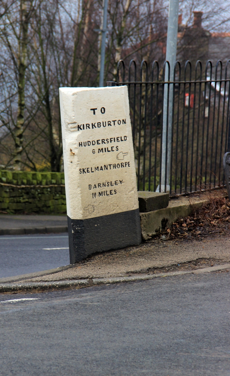
6/50 Guide post at junction
with Far Bank
II
Guide post. Mid C19. Triangular stone post inscribed on two faces
and with pointing hands to indicate direction:
TO TO
SHEPLEY KIRKBURTON
HOLMFIRTH 6 MILES
5 MILES SKELMANTHORPE
BARNSLEY
11 MILES
Listing NGR: SE2049011181
External links are from the relevant listing authority and, where applicable, Wikidata. Wikidata IDs may be related buildings as well as this specific building. If you want to add or update a link, you will need to do so by editing the Wikidata entry.


Other nearby listed buildings
