Approximate Location Map
Large Map »
Latitude: 51.4727 / 51°28'21"N
Longitude: -0.9122 / 0°54'43"W
OS Eastings: 475648
OS Northings: 175423
OS Grid: SU756754
Mapcode National: GBR C5J.Q5N
Mapcode Global: VHDWV.47LV
Plus Code: 9C3XF3FQ+34
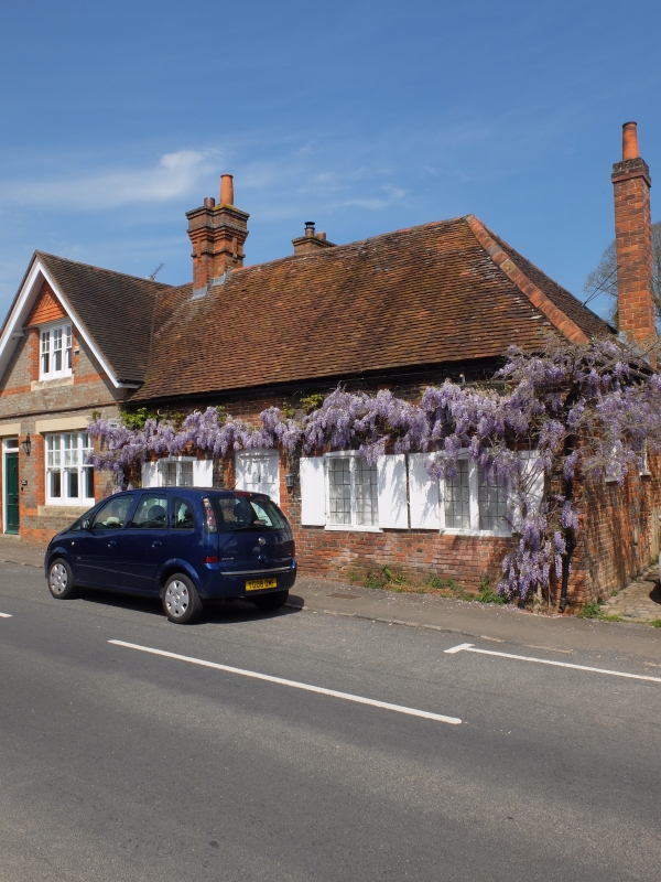
Entry Name: Wisteria
Listing Date: 17 October 1983
Grade: II
Source: Historic England
Source ID: 1135889
English Heritage Legacy ID: 41183
ID on this website: 101135889
Location: Sonning, Wokingham, Berkshire, RG4
County: Wokingham
Civil Parish: Sonning
Built-Up Area: Woodley
Traditional County: Berkshire
Lieutenancy Area (Ceremonial County): Berkshire
Church of England Parish: Sonning
Church of England Diocese: Oxford
Tagged with: Building
SU 7575 SONNING PEARSON ROAD
(north side)
14/19
Wisteria
GV
II
Cottage. C18, one storey, chequerbrick with red dressings, old tile roof
hipped to right hand. South front originally of 4 bays, 2-light leaded
casement windows in segmental headed wood frames with shutters and 6 panelled
door in moulded wood frame in second bay from left. Later extension to left
hand.
Listing NGR: SU7564875423
External links are from the relevant listing authority and, where applicable, Wikidata. Wikidata IDs may be related buildings as well as this specific building. If you want to add or update a link, you will need to do so by editing the Wikidata entry.


Other nearby listed buildings
