Approximate Location Map
Large Map »
Latitude: 51.4395 / 51°26'22"N
Longitude: -2.8421 / 2°50'31"W
OS Eastings: 341565
OS Northings: 171498
OS Grid: ST415714
Mapcode National: GBR JD.NFT2
Mapcode Global: VH7C7.P2CV
Plus Code: 9C3VC5Q5+Q5
Entry Name: Barbette Stonebridge
Listing Date: 22 January 1976
Grade: II
Source: Historic England
Source ID: 1136344
English Heritage Legacy ID: 33053
ID on this website: 101136344
Location: East Clevedon, North Somerset, BS21
County: North Somerset
Civil Parish: Clevedon
Built-Up Area: Clevedon
Traditional County: Somerset
Lieutenancy Area (Ceremonial County): Somerset
Tagged with: Architectural structure
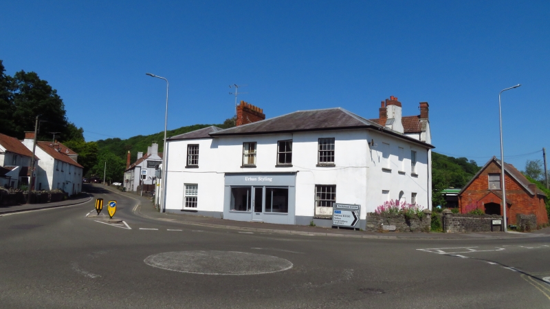
EAST CLEVEDON TRIANGLE
1.
5l21
(East Side)
Barbette and
Stonebridge
ST 4171 1/3
II GV
2.
One early C19 villa on site between Walton Road and Tickenham Road. 2 storey
roughcast front. Hipped slate roofs with projecting eaves. 3 windows, sashes
with glazing bars to sides only. Inserted shop front in centre. Included for
group value.
All the buildings listed in the Triangle, East Clevedon, (including Byegones in
Highdale Road) form a group
Listing NGR: ST4156571498
External links are from the relevant listing authority and, where applicable, Wikidata. Wikidata IDs may be related buildings as well as this specific building. If you want to add or update a link, you will need to do so by editing the Wikidata entry.


Other nearby listed buildings
