Approximate Location Map
Large Map »
Latitude: 50.1586 / 50°9'31"N
Longitude: -5.4507 / 5°27'2"W
OS Eastings: 153631
OS Northings: 34432
OS Grid: SW536344
Mapcode National: GBR DXX8.B2P
Mapcode Global: VH12T.G8TQ
Plus Code: 9C2P5G5X+FP
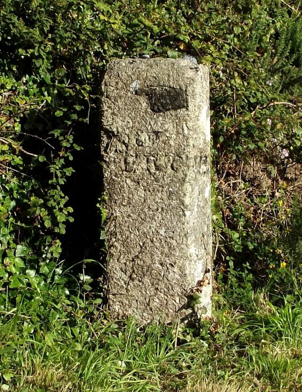
Entry Name: Guide Post at SW 536344
Listing Date: 7 September 1988
Grade: II
Source: Historic England
Source ID: 1136648
English Heritage Legacy ID: 70414
ID on this website: 101136648
Location: Canon's Town, Cornwall, TR27
County: Cornwall
Civil Parish: St. Erth
Traditional County: Cornwall
Lieutenancy Area (Ceremonial County): Cornwall
Church of England Parish: St Erth
Church of England Diocese: Truro
Tagged with: Milestone Fingerpost
LUDGVAN TREDEA LANE
SW 53 SW
8/66 Guide post at SW 536344
- II
Guide post. Dressed granite monolith. Triangular on plan with the 2 road-facing
sides inscribed with incised letters and hand pointers.
Left-hand face: ST ERTH with right hand corner broken.
Right-hand face: ST HILARY.
Listing NGR: SW5363134431
External links are from the relevant listing authority and, where applicable, Wikidata. Wikidata IDs may be related buildings as well as this specific building. If you want to add or update a link, you will need to do so by editing the Wikidata entry.


Other nearby listed buildings
