Approximate Location Map
Large Map »
Latitude: 50.2155 / 50°12'55"N
Longitude: -5.4787 / 5°28'43"W
OS Eastings: 151924
OS Northings: 40845
OS Grid: SW519408
Mapcode National: GBR DXV3.P7Y
Mapcode Global: VH12D.ZVH5
Plus Code: 9C2P6G8C+5G
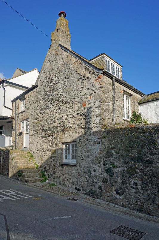
Entry Name: 5, Fish Street
Listing Date: 4 June 1952
Grade: II
Source: Historic England
Source ID: 1136789
English Heritage Legacy ID: 68978
ID on this website: 101136789
Location: St Ives, Cornwall, TR26
County: Cornwall
Civil Parish: St. Ives
Built-Up Area: St Ives
Traditional County: Cornwall
Lieutenancy Area (Ceremonial County): Cornwall
Church of England Parish: St Ives
Church of England Diocese: Truro
Tagged with: Building
FISH STREET
1. -----------
1587 No 5
SW 54 SW 1/270 4.6.52.
II
2.
Probably C17. Stone rubble cottage. Roof of scantle slates cement broomed.
Two storeys and attic. Modern casements with glazing bars. Hipped dormer.
Hipped roof with gable end to road. Massive chimney stack on front with
upper stage missing. Claimed as the oldest house in St Ives.
Listing NGR: SW5192440845
External links are from the relevant listing authority and, where applicable, Wikidata. Wikidata IDs may be related buildings as well as this specific building. If you want to add or update a link, you will need to do so by editing the Wikidata entry.


Other nearby listed buildings
