Approximate Location Map
Large Map »
Latitude: 50.2123 / 50°12'44"N
Longitude: -5.481 / 5°28'51"W
OS Eastings: 151742
OS Northings: 40493
OS Grid: SW517404
Mapcode National: GBR DXV3.VKF
Mapcode Global: VH12D.YX8N
Plus Code: 9C2P6G69+WH
Entry Name: The Queen's Hotel
Listing Date: 4 June 1952
Last Amended: 22 December 1972
Grade: II
Source: Historic England
Source ID: 1136848
English Heritage Legacy ID: 69025
ID on this website: 101136848
Location: St Ives, Cornwall, TR26
County: Cornwall
Civil Parish: St. Ives
Built-Up Area: St Ives
Traditional County: Cornwall
Lieutenancy Area (Ceremonial County): Cornwall
Church of England Parish: St Ives
Church of England Diocese: Truro
Tagged with: Hotel
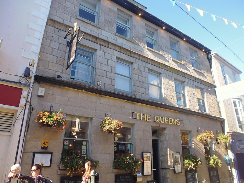
HIGH STREET
1. (North Side)
1587 ------------
The Queen's Hotel
SW 54 SW l/103 4.6.52.
II GV
2.
C1819. Granite ashlar. Well proportioned. Two string courses, coved band
at second floor level. Three storeys. Five windows, sashes, no glazing
bars. Central door, fielded panels, rectangular fanlingt. Boarded eaves
soffit.
All the listed buildings on the North Side form a group.
Listing NGR: SW5174240493
External links are from the relevant listing authority and, where applicable, Wikidata. Wikidata IDs may be related buildings as well as this specific building. If you want to add or update a link, you will need to do so by editing the Wikidata entry.


Other nearby listed buildings
