Approximate Location Map
Large Map »
Latitude: 50.2158 / 50°12'56"N
Longitude: -5.4778 / 5°28'40"W
OS Eastings: 151987
OS Northings: 40879
OS Grid: SW519408
Mapcode National: GBR DXV3.PMV
Mapcode Global: VH12F.0TFX
Plus Code: 9C2P6G8C+8V
Entry Name: 1, Island Square
Listing Date: 22 December 1972
Grade: II
Source: Historic England
Source ID: 1136860
English Heritage Legacy ID: 69030
ID on this website: 101136860
Location: St Ives, Cornwall, TR26
County: Cornwall
Civil Parish: St. Ives
Built-Up Area: St Ives
Traditional County: Cornwall
Lieutenancy Area (Ceremonial County): Cornwall
Church of England Parish: St Ives
Church of England Diocese: Truro
Tagged with: Building
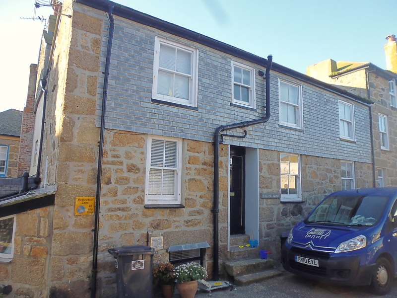
ISLAND SQUARE
1. -------------
1587 No 1
SW 54 SW 1/108
II GV
2.
Early C19. Granite rubble slate hung above ground floor. Two storeys.
Three windows, sashes, no glazing bars, Three steps to panelled door.
Slate roof with gable end. Group value.
Nos 1 and 2 form a group.
Listing NGR: SW5198740879
External links are from the relevant listing authority and, where applicable, Wikidata. Wikidata IDs may be related buildings as well as this specific building. If you want to add or update a link, you will need to do so by editing the Wikidata entry.


Other nearby listed buildings
