Approximate Location Map
Large Map »
Latitude: 51.3943 / 51°23'39"N
Longitude: -2.3327 / 2°19'57"W
OS Eastings: 376947
OS Northings: 166188
OS Grid: ST769661
Mapcode National: GBR 0QB.K1W
Mapcode Global: VH96M.J740
Plus Code: 9C3V9MV8+PW
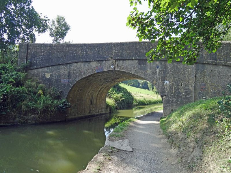
Entry Name: Bridge over the Kennet and Avon Canal
Listing Date: 1 February 1956
Grade: II
Source: Historic England
Source ID: 1137009
English Heritage Legacy ID: 32017
ID on this website: 101137009
Location: Lambridge, Bath and North East Somerset, Somerset, BA2
County: Bath and North East Somerset
Civil Parish: Bathampton
Built-Up Area: Bath
Traditional County: Somerset
Lieutenancy Area (Ceremonial County): Somerset
Tagged with: Bridge
ST 76 NE BATHAMPTON C.P. MEADOW LANE
1/16 Bridge over the Kennet and
1.2.56 Avon Canal
G.V. II
Bridge over the Kennet and Avon Canal. Early C19th, canal opened 1810. John
Rennie was the engineer for the canal. Ashlar. Single span horseshoe arch
with triple keystone. Plat band and parapet.
Listing NGR: ST7694766188
External links are from the relevant listing authority and, where applicable, Wikidata. Wikidata IDs may be related buildings as well as this specific building. If you want to add or update a link, you will need to do so by editing the Wikidata entry.


Other nearby listed buildings
