Approximate Location Map
Large Map »
Latitude: 50.2115 / 50°12'41"N
Longitude: -5.4787 / 5°28'43"W
OS Eastings: 151901
OS Northings: 40404
OS Grid: SW519404
Mapcode National: GBR DXV3.WS7
Mapcode Global: VH12D.ZYG7
Plus Code: 9C2P6G6C+JG
Entry Name: St Ives Arts Club
Listing Date: 22 December 1972
Grade: II
Source: Historic England
Source ID: 1137048
English Heritage Legacy ID: 69142
ID on this website: 101137048
Location: St Ives, Cornwall, TR26
County: Cornwall
Civil Parish: St. Ives
Built-Up Area: St Ives
Traditional County: Cornwall
Lieutenancy Area (Ceremonial County): Cornwall
Church of England Parish: St Ives
Church of England Diocese: Truro
Tagged with: Clubhouse
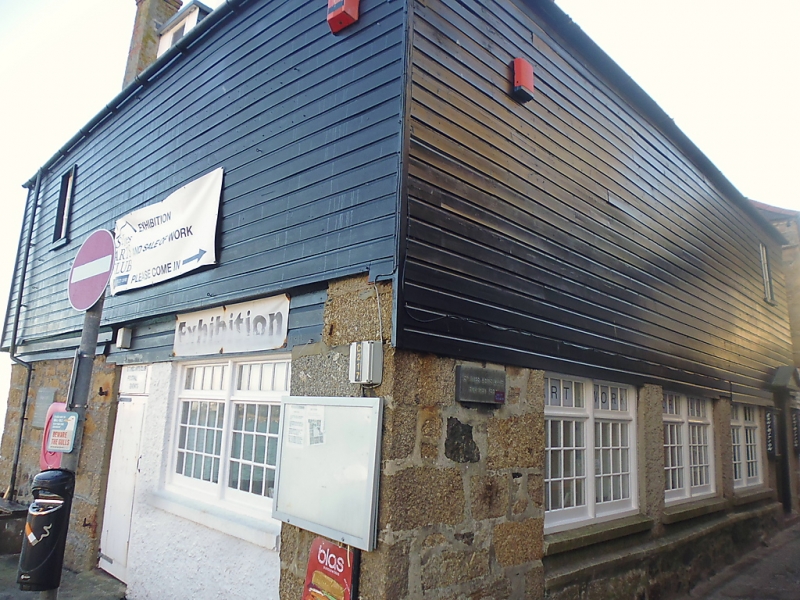
THE WARREN
1. -----------
1587 St Ives Arts Club
SW 54 SW 1/172
II GV
2.
Mid C19 converted corn mill. It is prominenly situated on sea wall.
Approximately 40 ft square, ground floor of uncoursed rubble, first floor
of tarred boards, hipped roof of slurried slates. -- - -
Irregular fenestration, C20 casements and double-hung sashes. Dormers.
St Ives Art Club and Nos 3 and 5 form a group.
Listing NGR: SW5190140404
External links are from the relevant listing authority and, where applicable, Wikidata. Wikidata IDs may be related buildings as well as this specific building. If you want to add or update a link, you will need to do so by editing the Wikidata entry.


Other nearby listed buildings
