Approximate Location Map
Large Map »
Latitude: 51.3584 / 51°21'30"N
Longitude: -2.9987 / 2°59'55"W
OS Eastings: 330560
OS Northings: 162623
OS Grid: ST305626
Mapcode National: GBR J5.TQFN
Mapcode Global: VH7CJ.Z32Z
Plus Code: 9C3V9252+9G
Entry Name: North Jetty
Listing Date: 19 May 1983
Grade: II
Source: Historic England
Source ID: 1137504
English Heritage Legacy ID: 33183
ID on this website: 101137504
Location: North Somerset, BS22
County: North Somerset
Civil Parish: Weston-super-Mare
Built-Up Area: Weston-Super-Mare
Lieutenancy Area (Ceremonial County): Somerset
Tagged with: Building
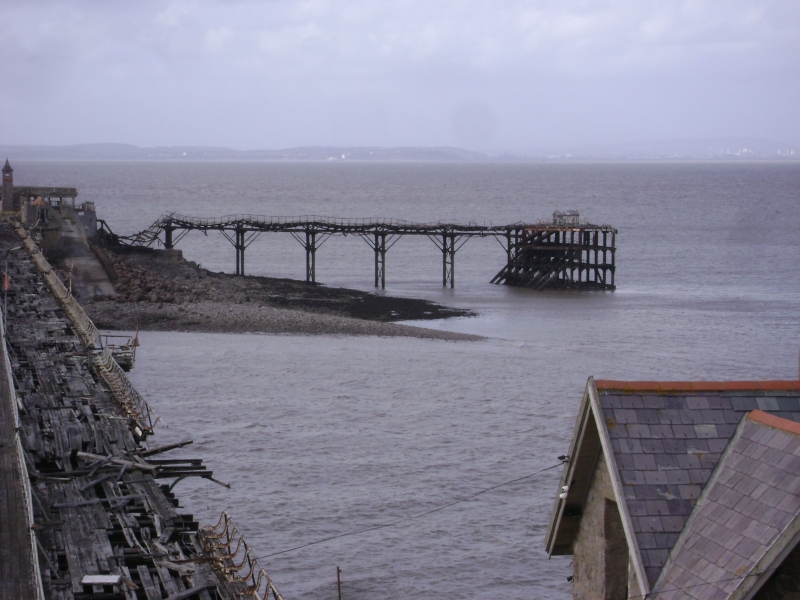
BIRNBECK PIER
1.
5121
North Jetty
ST 36 SW 1/8
II GV
2.
Probably late 1860's but extensively repaired 1903-1905. Runs north from the
island. Iron cross-girders support the deck. Coupled tubular shafts with diagonal
braces run from the sea to the girders. At outer end a landing stage, with densely
clustered supports with some diagonal bracing on south side. Tiny pavilion.
Listing NGR: ST3056062623
External links are from the relevant listing authority and, where applicable, Wikidata. Wikidata IDs may be related buildings as well as this specific building. If you want to add or update a link, you will need to do so by editing the Wikidata entry.


Other nearby listed buildings
