Approximate Location Map
Large Map »
Latitude: 54.5119 / 54°30'42"N
Longitude: -1.0615 / 1°3'41"W
OS Eastings: 460857
OS Northings: 513360
OS Grid: NZ608133
Mapcode National: GBR PJ08.ZD
Mapcode Global: WHF8D.NVQG
Plus Code: 9C6WGW6Q+Q9
Entry Name: Boundary Wall South of Highcliff Farmhouse
Listing Date: 25 April 1984
Grade: II
Source: Historic England
Source ID: 1139777
English Heritage Legacy ID: 59956
ID on this website: 101139777
Location: Hutton Village, Redcar and Cleveland, North Yorkshire, TS14
County: Redcar and Cleveland
Civil Parish: Guisborough
Traditional County: Yorkshire
Lieutenancy Area (Ceremonial County): North Yorkshire
Church of England Parish: Guisborough St Nicholas
Church of England Diocese: York
Tagged with: Wall
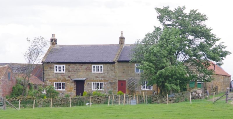
NZ61SW GUISBOROUGH HIGHCLIFF ROAD
HUTTON VILLAGE
5/90 Boundary wall S.
of Highcliff
Farmhouse
GV II
Boundary wall enclosing garden of farmhouse. Early C.18. Dry-
stone: random rubble sandstone.
Listing NGR: NZ6085713360
External links are from the relevant listing authority and, where applicable, Wikidata. Wikidata IDs may be related buildings as well as this specific building. If you want to add or update a link, you will need to do so by editing the Wikidata entry.


Other nearby listed buildings
