Approximate Location Map
Large Map »
Latitude: 52.9698 / 52°58'11"N
Longitude: -1.4146 / 1°24'52"W
OS Eastings: 439409
OS Northings: 341545
OS Grid: SK394415
Mapcode National: GBR 6DC.WNT
Mapcode Global: WHDGN.7MM3
Plus Code: 9C4WXH9P+W4
Entry Name: Milepost at Os 394 414
Listing Date: 6 November 1986
Grade: II
Source: Historic England
Source ID: 1140417
English Heritage Legacy ID: 352291
ID on this website: 101140417
Location: Morley Smithy, Erewash, Derbyshire, DE7
County: Derbyshire
District: Erewash
Civil Parish: Morley
Traditional County: Derbyshire
Lieutenancy Area (Ceremonial County): Derbyshire
Church of England Parish: Morley St Matthew
Church of England Diocese: Derby
Tagged with: Milestone
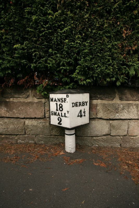
PARISH OF MORLEY MANSFIELD ROAD
SK 34 SE
1/88 MORLEY SMITHY
(West Side)
Mile Post at
OS 394 416
II
Mile post. Early C19. Cast iron. Triangular, on a short
circular shaft. Inscribed on shaft MORLEY, and on the body
MANSFd/18/SMALLy/2/DERBY/4.
Listing NGR: SK3940941544
External links are from the relevant listing authority and, where applicable, Wikidata. Wikidata IDs may be related buildings as well as this specific building. If you want to add or update a link, you will need to do so by editing the Wikidata entry.


Other nearby listed buildings
