Approximate Location Map
Large Map »
Latitude: 50.2517 / 50°15'6"N
Longitude: -5.1887 / 5°11'19"W
OS Eastings: 172777
OS Northings: 43944
OS Grid: SW727439
Mapcode National: GBR Z6.083N
Mapcode Global: FRA 080C.JC4
Plus Code: 9C2P7R26+MG
Entry Name: Milepost on West Side of B3298 at SW 727 439
Listing Date: 12 September 1989
Grade: II
Source: Historic England
Source ID: 1142547
English Heritage Legacy ID: 66897
ID on this website: 101142547
Location: Scorrier, Cornwall, TR16
County: Cornwall
Civil Parish: St. Day
Built-Up Area: Redruth
Traditional County: Cornwall
Lieutenancy Area (Ceremonial County): Cornwall
Church of England Parish: St Day
Church of England Diocese: Truro
Tagged with: Milestone
ST DAY
SW 74 SW
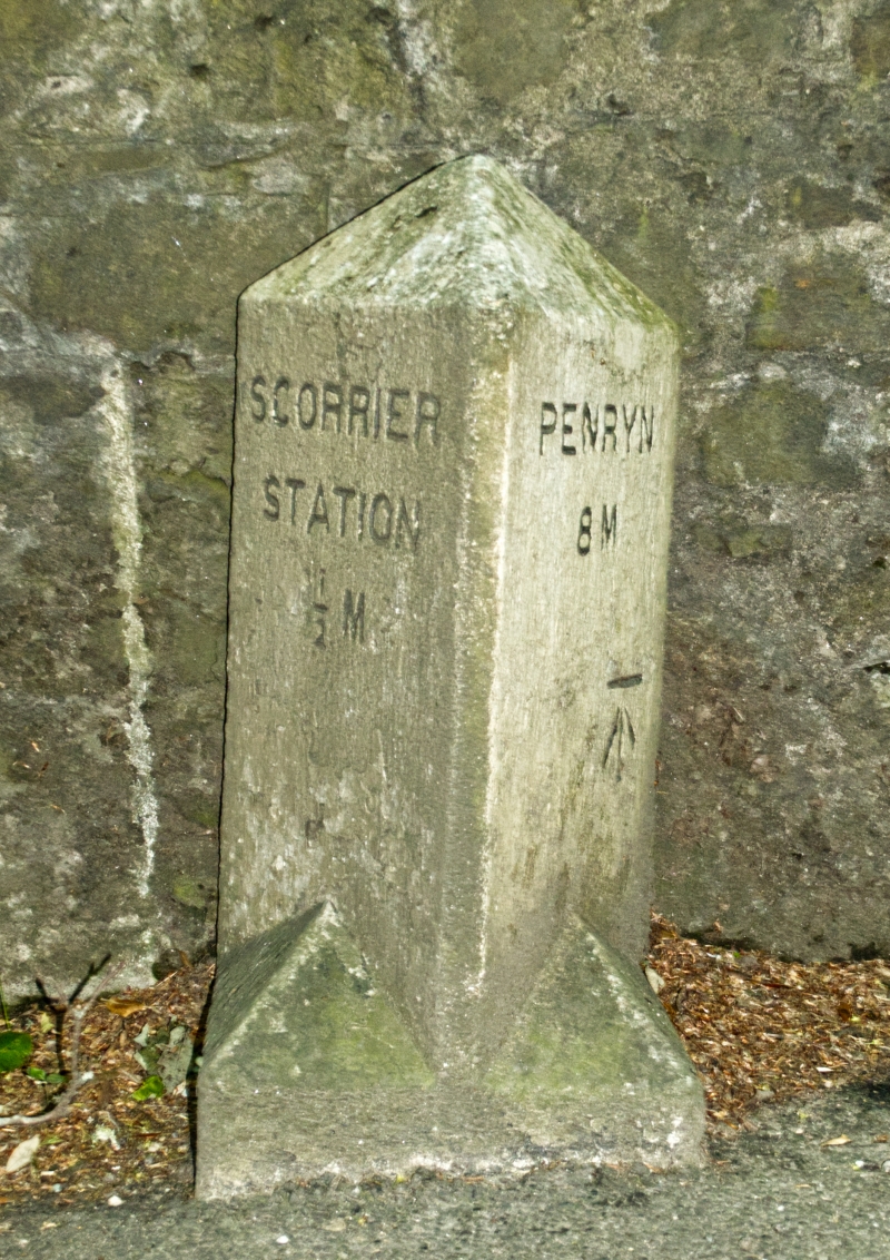
6/332 Milepost on west side of B 3298
at SW 727 439
II
Milepost. Later C19. Dressed granite monolith. Triangular type, the sides
inscribed:-
SCORRIER PENRYN
STATION 8 M
½ M
Listing NGR: SW7277743944
External links are from the relevant listing authority and, where applicable, Wikidata. Wikidata IDs may be related buildings as well as this specific building. If you want to add or update a link, you will need to do so by editing the Wikidata entry.


Other nearby listed buildings
