Approximate Location Map
Large Map »
Latitude: 50.1178 / 50°7'3"N
Longitude: -5.5361 / 5°32'10"W
OS Eastings: 147311
OS Northings: 30177
OS Grid: SW473301
Mapcode National: GBR DXQC.LXQ
Mapcode Global: VH12Z.093K
Plus Code: 9C2P4F97+4G
Entry Name: 8, Chapel Street
Listing Date: 7 February 1974
Grade: II
Source: Historic England
Source ID: 1143148
English Heritage Legacy ID: 69439
ID on this website: 101143148
Location: Penzance, Cornwall, TR18
County: Cornwall
Civil Parish: Penzance
Built-Up Area: Penzance
Traditional County: Cornwall
Lieutenancy Area (Ceremonial County): Cornwall
Church of England Parish: Penzance St Mary the Virgin with St Paul
Church of England Diocese: Truro
Tagged with: Building
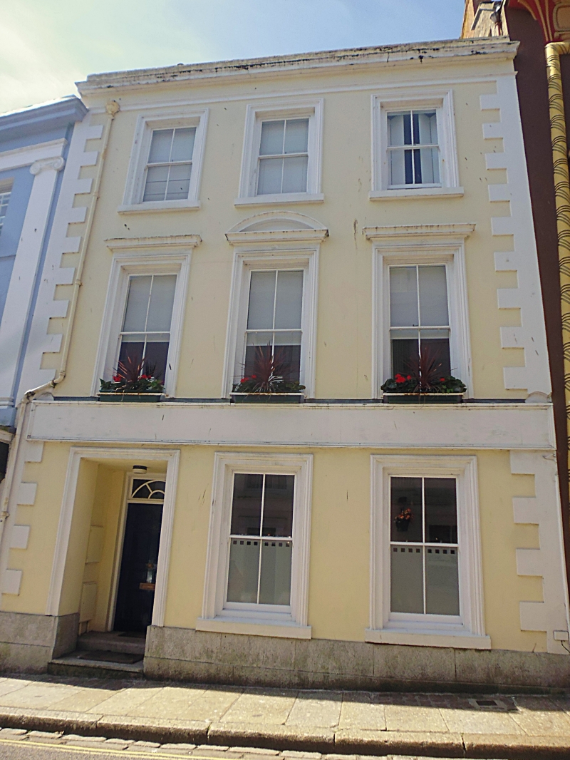
1.
1498 PENZANCE
CHAPEL STREET
(South West Side)
No 8
SW 4730 5/471
II GV
2.
Mid C19. Stucco. Parapet and cornice. 3 .storeys. 3 windows, sashes, no glazing
bars, moulded architraves, 1st floor cornices and segmental pediment to centre
window. Quoins. Large modern recessed shop front. Included for group value.
Nos 5 to 11 (consec) form a group.
Listing NGR: SW4731130177
External links are from the relevant listing authority and, where applicable, Wikidata. Wikidata IDs may be related buildings as well as this specific building. If you want to add or update a link, you will need to do so by editing the Wikidata entry.


Other nearby listed buildings
