Approximate Location Map
Large Map »
Latitude: 50.2069 / 50°12'24"N
Longitude: -5.4973 / 5°29'50"W
OS Eastings: 150553
OS Northings: 39957
OS Grid: SW505399
Mapcode National: GBR DXT4.6QP
Mapcode Global: VH12L.N2N6
Plus Code: 9C2P6G43+Q3
Entry Name: Fairings
Listing Date: 22 December 1972
Grade: II
Source: Historic England
Source ID: 1143347
English Heritage Legacy ID: 69020
ID on this website: 101143347
Location: Cornwall, TR26
County: Cornwall
Civil Parish: St. Ives
Built-Up Area: St Ives
Traditional County: Cornwall
Lieutenancy Area (Ceremonial County): Cornwall
Church of England Parish: Halsetown
Church of England Diocese: Truro
Tagged with: Building
HELLESVEAN ROAD
1. HELLESVEAN
1587 ---------------
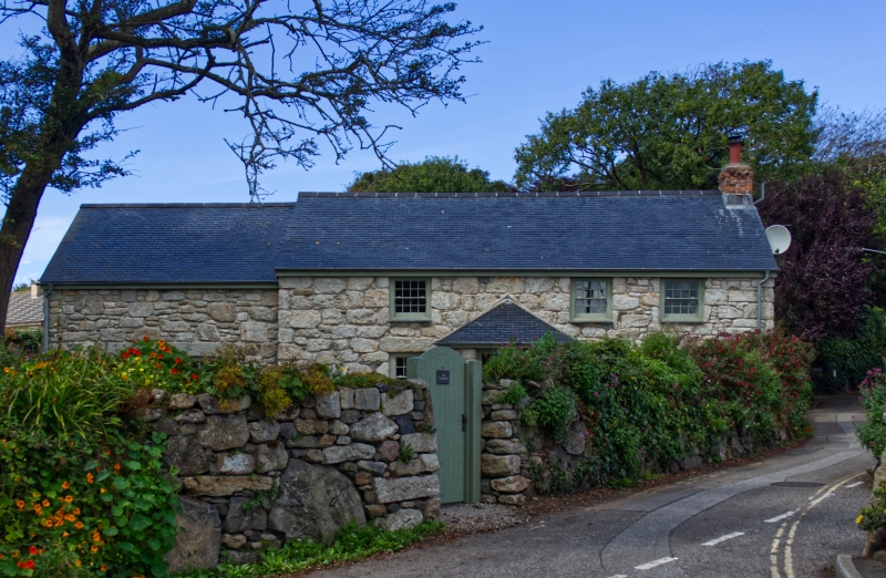
Fairings
SW 54 NW 5/206
II
2.
C18. Cottage. Painted rubble. Two storeys. Three windows, renewed sashes
with glazing bars. Central door, modern porch. Slurried slate roof with
gable ends.
Listing NGR: SW5055339957
External links are from the relevant listing authority and, where applicable, Wikidata. Wikidata IDs may be related buildings as well as this specific building. If you want to add or update a link, you will need to do so by editing the Wikidata entry.


Other nearby listed buildings
