Approximate Location Map
Large Map »
Latitude: 50.2151 / 50°12'54"N
Longitude: -5.4807 / 5°28'50"W
OS Eastings: 151780
OS Northings: 40813
OS Grid: SW517408
Mapcode National: GBR DXV3.NB9
Mapcode Global: VH12D.YVFG
Plus Code: 9C2P6G89+3P
Entry Name: 20, 22 and 24, Digey Street
Listing Date: 22 December 1972
Grade: II
Source: Historic England
Source ID: 1143370
English Heritage Legacy ID: 68975
ID on this website: 101143370
Location: St Ives, Cornwall, TR26
County: Cornwall
Civil Parish: St. Ives
Built-Up Area: St Ives
Traditional County: Cornwall
Lieutenancy Area (Ceremonial County): Cornwall
Church of England Parish: St Ives
Church of England Diocese: Truro
Tagged with: Building
SW 54 SW 1/60
1587
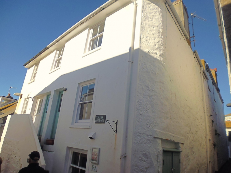
DIGEY STREET
(North-east Side)
Nos 20, 22, and 24
GV
II
C18/19. Stucco faced rubble. three storeys. Three windows, sashes, no
glazing bars, plain architraves. Steps to first floor doors, modern
glazed doors. Overhanging eaves. Slate hipped roof. Group value.
All the listed building from Nos 12 to 32 (even) form a group.
Listing NGR: SW5178040813
External links are from the relevant listing authority and, where applicable, Wikidata. Wikidata IDs may be related buildings as well as this specific building. If you want to add or update a link, you will need to do so by editing the Wikidata entry.


Other nearby listed buildings
