Approximate Location Map
Large Map »
Latitude: 54.948 / 54°56'52"N
Longitude: -3.186 / 3°11'9"W
OS Eastings: 324129
OS Northings: 562121
OS Grid: NY241621
Mapcode National: GBR 6C67.03
Mapcode Global: WH6YG.1W3P
Plus Code: 9C6RWRX7+5H
Entry Name: Canal Lock
Listing Date: 8 November 1984
Grade: II
Source: Historic England
Source ID: 1144631
English Heritage Legacy ID: 71918
ID on this website: 101144631
Location: Port Carlisle, Cumberland, Cumbria, CA7
County: Cumbria
District: Allerdale
Civil Parish: Bowness
Traditional County: Cumberland
Lieutenancy Area (Ceremonial County): Cumbria
Church of England Parish: Bowness-on-Solway St Michael
Church of England Diocese: Carlisle
Tagged with: Lock
NY 26 SW BOWNESS Port Carlisle
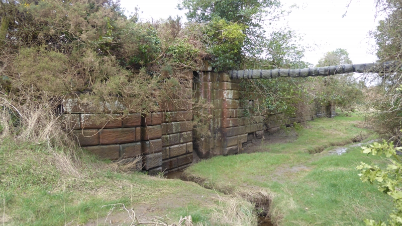
2/40 Canal lock
II
Canal lock. 1819-1823 for the Carlisle Canal. Red sandstone ashlar with
V-joints. Standard canal lock for vessels up to 100 tons: gave access from
Canal Basin to the canal. In use until 1853.
Listing NGR: NY2412962121
External links are from the relevant listing authority and, where applicable, Wikidata. Wikidata IDs may be related buildings as well as this specific building. If you want to add or update a link, you will need to do so by editing the Wikidata entry.


Other nearby listed buildings
