Approximate Location Map
Large Map »
Latitude: 51.1321 / 51°7'55"N
Longitude: 1.3031 / 1°18'11"E
OS Eastings: 631193
OS Northings: 142170
OS Grid: TR311421
Mapcode National: GBR X2S.SCB
Mapcode Global: VHLHB.JTR0
Plus Code: 9F3348J3+R6
Entry Name: Buckland Place
Listing Date: 17 December 1973
Grade: II
Source: Historic England
Source ID: 1145856
English Heritage Legacy ID: 177797
ID on this website: 101145856
Location: Dover, Kent, CT17
County: Kent
District: Dover
Civil Parish: Dover
Built-Up Area: Dover
Traditional County: Kent
Lieutenancy Area (Ceremonial County): Kent
Tagged with: Building
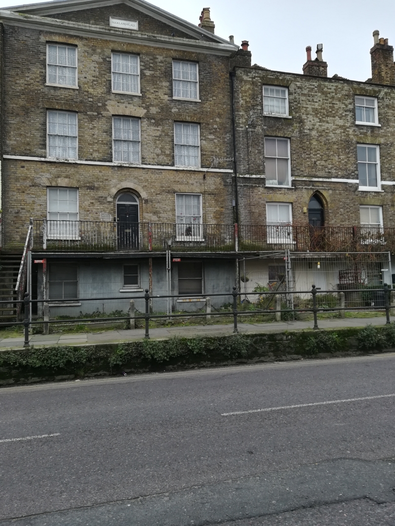
LONDON ROAD
1. (South West Side)
1050
Nos 295 to 300 (consec)
(Buckland Place )
TR 3142 3/134
II GV
2.
Grade II as a group. 4 storeys and basements brown brick. No 298 has a
pediment. 1 sash to all except to No 298 which has 3 with glazing bars intact.
Doorcases approached up flights of steps. No 299 has a 1st floor 3 light
canted bay. Nos 295, 296 and 297 have ogee-shaped doors.
Nos 279 to 319 (consec) form a group.
Listing NGR: TR3119342170
External links are from the relevant listing authority and, where applicable, Wikidata. Wikidata IDs may be related buildings as well as this specific building. If you want to add or update a link, you will need to do so by editing the Wikidata entry.


Other nearby listed buildings
