Approximate Location Map
Large Map »
Latitude: 51.8836 / 51°53'0"N
Longitude: -0.5168 / 0°31'0"W
OS Eastings: 502182
OS Northings: 221596
OS Grid: TL021215
Mapcode National: GBR G50.VJ0
Mapcode Global: VHFRD.0X4F
Plus Code: 9C3XVFMM+C7
Entry Name: The White Swan Public House
Listing Date: 4 March 1976
Grade: II
Source: Historic England
Source ID: 1146325
English Heritage Legacy ID: 35753
ID on this website: 101146325
Location: Dunstable, Central Bedfordshire, LU6
County: Central Bedfordshire
Civil Parish: Dunstable
Built-Up Area: Dunstable
Traditional County: Bedfordshire
Lieutenancy Area (Ceremonial County): Bedfordshire
Church of England Parish: Dunstable
Church of England Diocese: St.Albans
Tagged with: Pub
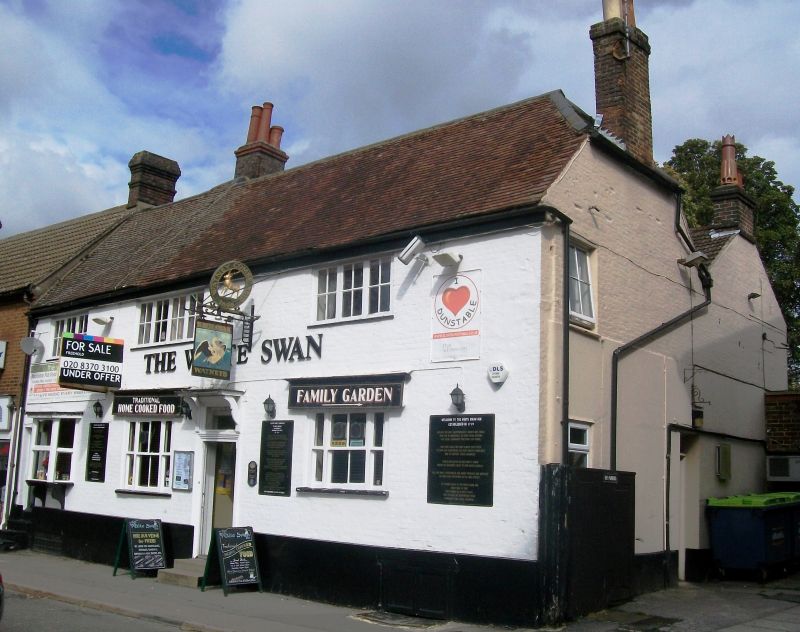
1.
5125 HIGH STREET SOUTH
(East Side)
Nos 91 & 93
(The White Swan Public House)
TL 0221 2/98
II
2.
C18. Whitewashed brick, old tiled roof half hipped on south. 2 storeys, corbelled
cornice. 3 casement windows, first floor glazing bars, ground floor small canted
oriel bay on left.
Listing NGR: TL0218221596
External links are from the relevant listing authority and, where applicable, Wikidata. Wikidata IDs may be related buildings as well as this specific building. If you want to add or update a link, you will need to do so by editing the Wikidata entry.


Other nearby listed buildings
