Approximate Location Map
Large Map »
Latitude: 51.3992 / 51°23'57"N
Longitude: -2.3042 / 2°18'15"W
OS Eastings: 378934
OS Northings: 166726
OS Grid: ST789667
Mapcode National: GBR 0QD.68X
Mapcode Global: VH96N.03Q7
Plus Code: 9C3V9MXW+M8
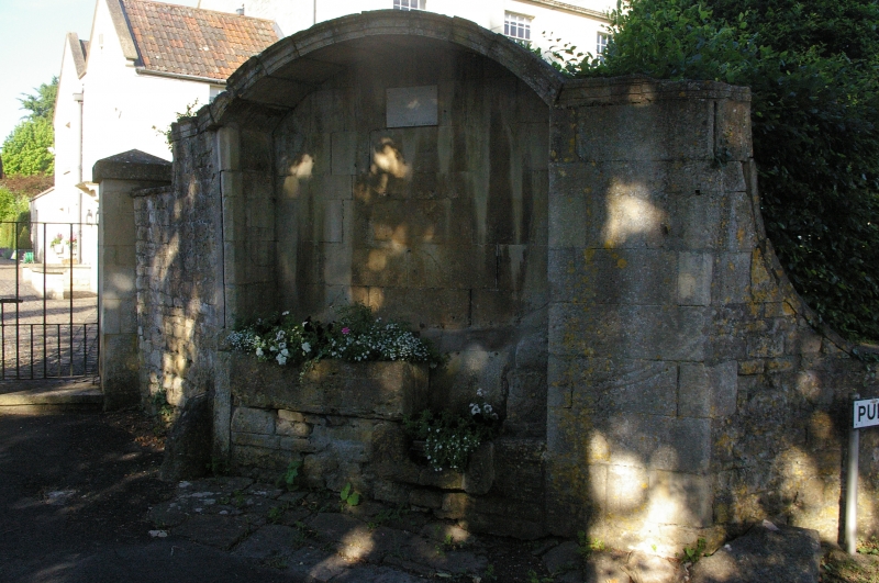
Entry Name: Water Trough Water Trough at North West End of Pump Lane
Listing Date: 19 October 1983
Grade: II
Source: Historic England
Source ID: 1146391
English Heritage Legacy ID: 32258
ID on this website: 101146391
Location: Bathford, Bath and North East Somerset, Somerset, BA1
County: Bath and North East Somerset
Civil Parish: Bathford
Built-Up Area: Bath
Traditional County: Somerset
Lieutenancy Area (Ceremonial County): Somerset
Tagged with: Watering trough
ST 7866-7966 BATHFORD C.P. PUMP LANE
9/85 Water trough at north-west
end of Pump Lane
G.V.
II
Water trough. Late C18th. Ashlar. Niche with moulded segmental arch head,
containing trough and overflow.
Listing NGR: ST7893466726
External links are from the relevant listing authority and, where applicable, Wikidata. Wikidata IDs may be related buildings as well as this specific building. If you want to add or update a link, you will need to do so by editing the Wikidata entry.


Other nearby listed buildings
