Approximate Location Map
Large Map »
Latitude: 51.9165 / 51°54'59"N
Longitude: -0.6627 / 0°39'45"W
OS Eastings: 492076
OS Northings: 225060
OS Grid: SP920250
Mapcode National: GBR F33.THN
Mapcode Global: VHFR9.G3J5
Plus Code: 9C3XW88P+HW
Entry Name: 39, High Street
Listing Date: 1 May 1975
Grade: II
Source: Historic England
Source ID: 1146519
English Heritage Legacy ID: 35625
ID on this website: 101146519
Location: Leighton Buzzard, Central Bedfordshire, LU7
County: Central Bedfordshire
Civil Parish: Leighton-Linslade
Built-Up Area: Leighton Buzzard
Traditional County: Bedfordshire
Lieutenancy Area (Ceremonial County): Bedfordshire
Church of England Parish: Leighton Buzzard
Church of England Diocese: St.Albans
Tagged with: Building
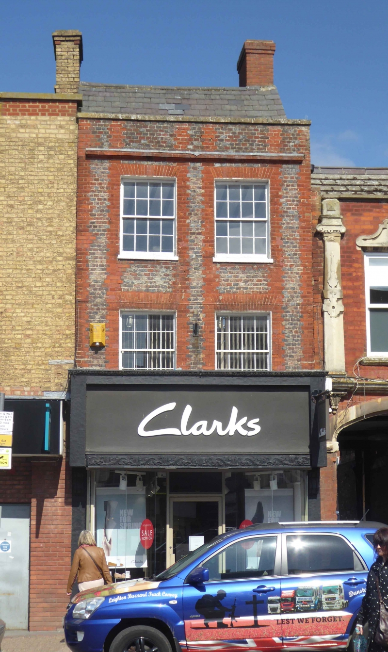
HIGH STREET
1.
5125
(North Side)
LEIGHTON BUZZARD
No 39
SP 9225 SW 1/16
II GV
2.
C18 house in local bond brickwork under steeply pitched gabled Welsh slated
roof. 3 storeys, 2 sash windows with glazing bars in reveals under flat arches.
Nos 55 to 51 (odd) and Nos 55 to 59 (odd) form a group.
Listing NGR: SP9207625060
External links are from the relevant listing authority and, where applicable, Wikidata. Wikidata IDs may be related buildings as well as this specific building. If you want to add or update a link, you will need to do so by editing the Wikidata entry.


Other nearby listed buildings
