Approximate Location Map
Large Map »
Latitude: 52.0316 / 52°1'53"N
Longitude: -0.4952 / 0°29'42"W
OS Eastings: 503332
OS Northings: 238091
OS Grid: TL033380
Mapcode National: GBR G39.MMT
Mapcode Global: VHFQT.C6LD
Plus Code: 9C4X2GJ3+JW
Entry Name: The Queen's Head
Listing Date: 16 March 1972
Grade: II
Source: Historic England
Source ID: 1146529
English Heritage Legacy ID: 37438
ID on this website: 101146529
Location: Ampthill, Central Bedfordshire, MK45
County: Central Bedfordshire
Civil Parish: Ampthill
Built-Up Area: Ampthill
Traditional County: Bedfordshire
Lieutenancy Area (Ceremonial County): Bedfordshire
Church of England Parish: Ampthill
Church of England Diocese: St.Albans
Tagged with: Architectural structure
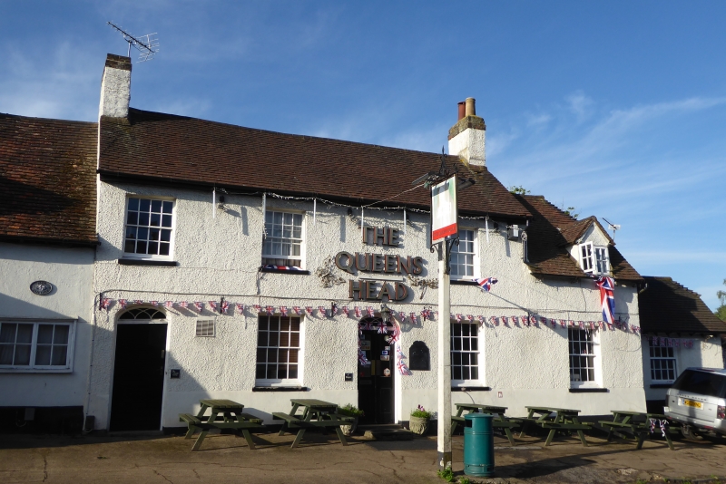
1.
774 WOBURN STREET
(South Side)
No 20 (the Queen's Head)
TL 0338 1/93
II GV
2.
Late C18. 2 storeys. Roughcast. Tiled roof. 4 windows in plain reveals.
To the west is a lower annexe of one storey and one window and a dormer
in the roof. 2 doors with blind fanlights in alcoves.
Nos 2 to 20 (even) form a group.
Listing NGR: TL0333238091
External links are from the relevant listing authority and, where applicable, Wikidata. Wikidata IDs may be related buildings as well as this specific building. If you want to add or update a link, you will need to do so by editing the Wikidata entry.


Other nearby listed buildings
