Approximate Location Map
Large Map »
Latitude: 54.4316 / 54°25'53"N
Longitude: -0.5333 / 0°31'59"W
OS Eastings: 495240
OS Northings: 505011
OS Grid: NZ952050
Mapcode National: GBR SKQ6.B5
Mapcode Global: WHGB5.SW71
Plus Code: 9C6XCFJ8+JM
Entry Name: Garden Wall to South of Number 3
Listing Date: 4 January 1990
Grade: II
Source: Historic England
Source ID: 1148642
English Heritage Legacy ID: 327851
ID on this website: 101148642
Location: Robin Hood's Bay, North Yorkshire, YO22
County: North Yorkshire
District: Scarborough
Civil Parish: Fylingdales
Traditional County: Yorkshire
Lieutenancy Area (Ceremonial County): North Yorkshire
Church of England Parish: Fylingdales St Stephen
Church of England Diocese: York
Tagged with: Wall
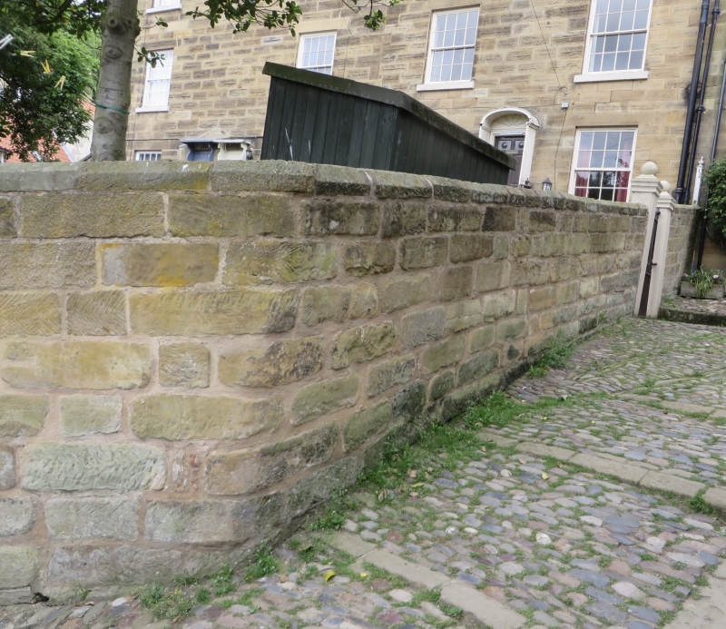
NZ 9505 FYLINGDALES SUNNY PLACE
Robin Hood's Bay
17/198
Garden wall to south
of No 3
GV II
Wall to right-hand side of front garden of No 3 (q.v.). Coursed sandstone. High
wall near house at right, sloping down to pair of square gate piers with stepped
cornices and ball finials. Included for group value.
Listing NGR: NZ9524005011
External links are from the relevant listing authority and, where applicable, Wikidata. Wikidata IDs may be related buildings as well as this specific building. If you want to add or update a link, you will need to do so by editing the Wikidata entry.


Other nearby listed buildings
