Approximate Location Map
Large Map »
Latitude: 54.083 / 54°4'58"N
Longitude: -0.8801 / 0°52'48"W
OS Eastings: 473360
OS Northings: 465813
OS Grid: SE733658
Mapcode National: GBR QP97.83
Mapcode Global: WHFBM.GM4R
Plus Code: 9C6X34M9+6X
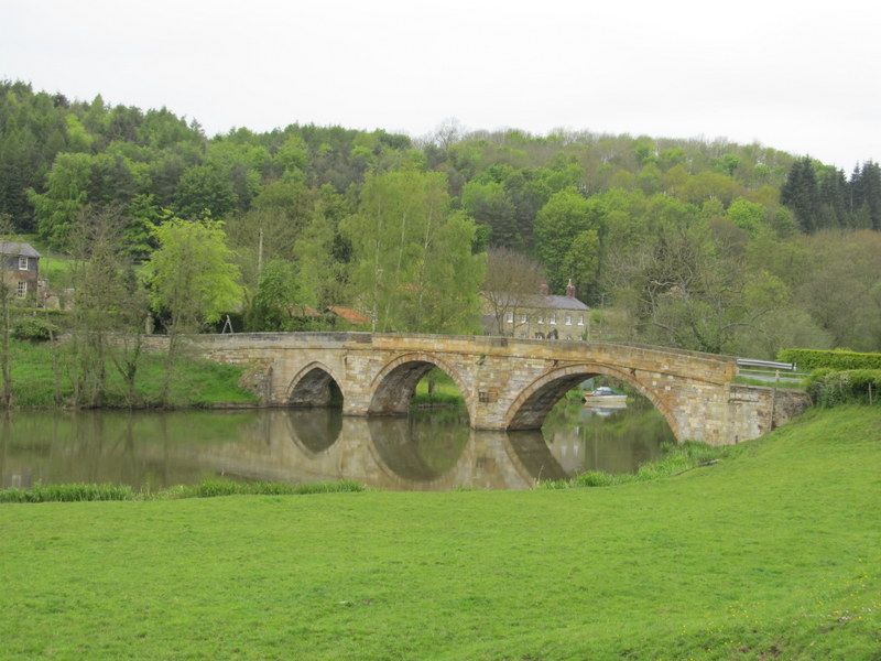
Entry Name: Kirkham Bridge
Listing Date: 10 October 1966
Grade: II
Source: Historic England
Source ID: 1149117
English Heritage Legacy ID: 328747
ID on this website: 101149117
Location: Kirkham, North Yorkshire, YO60
County: North Yorkshire
District: Ryedale
Civil Parish: Westow
Traditional County: Yorkshire
Lieutenancy Area (Ceremonial County): North Yorkshire
FIRBY KIRKHAM LANE
SE 76 NW
1/43 Kirkham Bridge
10.10.66
GV II
Bridge. 1806. By John Carr. Gritstone ashlar. One pointed arch and
2 segmental arches divided by cutwaters forming refuges on road. Band.
Chamfered parapet. North arch may preserve older work. Pevsner N,
Yorkshire, York and the East Riding, 1972.
Listing NGR: SE7336465814
External links are from the relevant listing authority and, where applicable, Wikidata. Wikidata IDs may be related buildings as well as this specific building. If you want to add or update a link, you will need to do so by editing the Wikidata entry.


Other nearby listed buildings
