Approximate Location Map
Large Map »
Latitude: 54.2676 / 54°16'3"N
Longitude: -0.9138 / 0°54'49"W
OS Eastings: 470842
OS Northings: 486320
OS Grid: SE708863
Mapcode National: GBR QM12.ZY
Mapcode Global: WHF9M.YZ1Q
Plus Code: 9C6X739P+3F
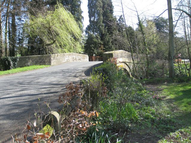
Entry Name: Keldholme Bridge
Listing Date: 5 June 1985
Grade: II
Source: Historic England
Source ID: 1149235
English Heritage Legacy ID: 328407
ID on this website: 101149235
Location: Keldholme, North Yorkshire, YO62
County: North Yorkshire
District: Ryedale
Civil Parish: Kirkbymoorside
Traditional County: Yorkshire
Lieutenancy Area (Ceremonial County): North Yorkshire
Church of England Parish: Kirkbymoorside All Saints
Church of England Diocese: York
Tagged with: Bridge
SE 78 NW KIRKYMOORSIDE KELDHOLME
3/49 Keldholme Bridge
II
Bridge. Early C18. Hammer-dressed sandstone; ashlar. Songle-span. Semi-
circular arch of voussoirs wider roll-moulding. Chamfered band and.
cramfered parapet.
Listing NGR: SE7084286320
External links are from the relevant listing authority and, where applicable, Wikidata. Wikidata IDs may be related buildings as well as this specific building. If you want to add or update a link, you will need to do so by editing the Wikidata entry.


Other nearby listed buildings
