Approximate Location Map
Large Map »
Latitude: 54.1363 / 54°8'10"N
Longitude: -1.5259 / 1°31'33"W
OS Eastings: 431076
OS Northings: 471261
OS Grid: SE310712
Mapcode National: GBR KNSM.G0
Mapcode Global: WHC7V.J9MD
Plus Code: 9C6W4FPF+GM
Entry Name: 20, Westgate
Listing Date: 6 May 1970
Grade: II
Source: Historic England
Source ID: 1150111
English Heritage Legacy ID: 330237
ID on this website: 101150111
Location: Ripon, North Yorkshire, HG4
County: North Yorkshire
District: Harrogate
Civil Parish: Ripon
Built-Up Area: Ripon
Traditional County: Yorkshire
Lieutenancy Area (Ceremonial County): North Yorkshire
Tagged with: Building
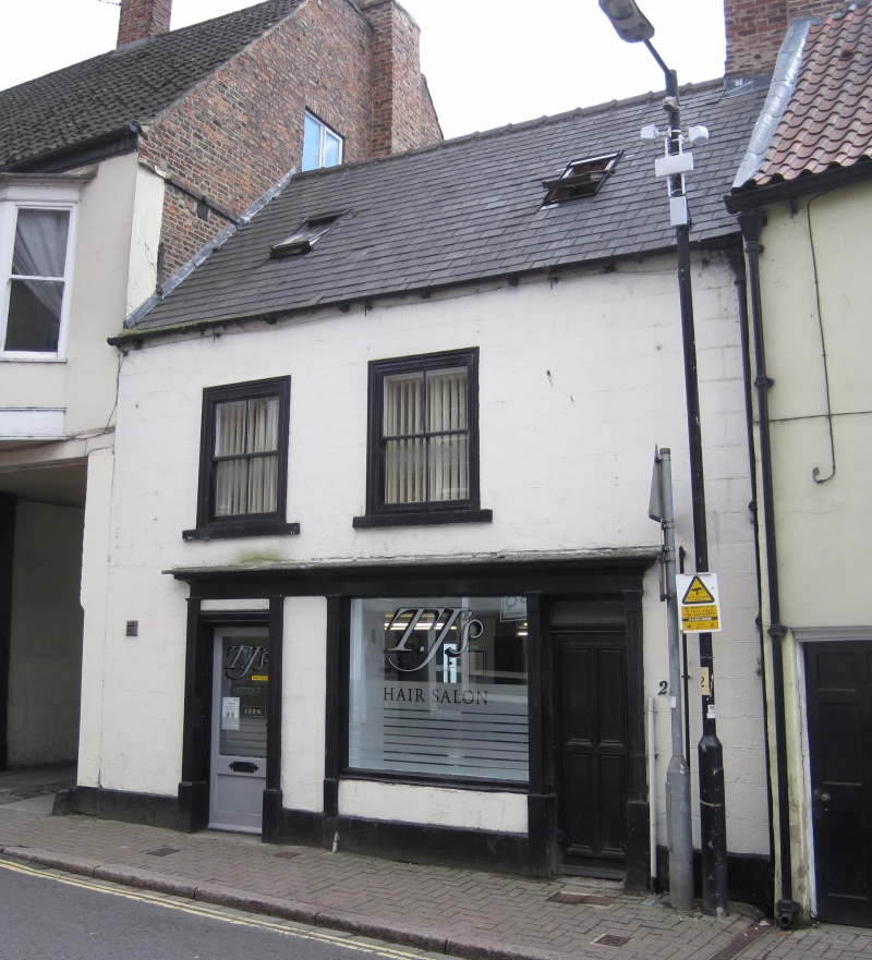
SE 3171 RIPON WESTGATE
1/110 (south side)
6.5.70
No 20
GV
II
probably C17, perhaps C18. Brick, rendered. Slate roof. Two storeys. One bay:
sash in moulded frame. Shopfront with sunk panelled pilasters and moulded cornice.
Interior. Diagonally placed hearths.
Listing NGR: SE3107671261
External links are from the relevant listing authority and, where applicable, Wikidata. Wikidata IDs may be related buildings as well as this specific building. If you want to add or update a link, you will need to do so by editing the Wikidata entry.


Other nearby listed buildings
