Approximate Location Map
Large Map »
Latitude: 53.5257 / 53°31'32"N
Longitude: -1.6141 / 1°36'50"W
OS Eastings: 425682
OS Northings: 403297
OS Grid: SE256032
Mapcode National: GBR KW5N.CV
Mapcode Global: WHCBQ.5MNZ
Plus Code: 9C5WG9GP+79
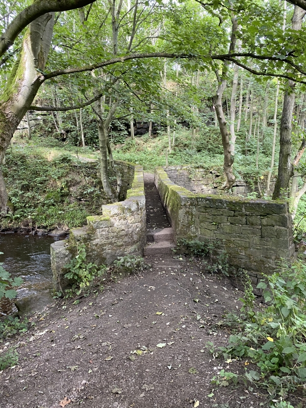
Entry Name: Boulder Bridge
Listing Date: 23 June 1965
Last Amended: 27 April 1988
Grade: II
Source: Historic England
Source ID: 1151835
English Heritage Legacy ID: 334096
ID on this website: 101151835
Location: Spring Vale, Barnsley, South Yorkshire, S36
County: Barnsley
Civil Parish: Penistone
Built-Up Area: Penistone
Traditional County: Yorkshire
Lieutenancy Area (Ceremonial County): South Yorkshire
Church of England Parish: Hoylandswaine St John the Evangelist
Church of England Diocese: Leeds
Tagged with: Bridge
PENISTONE SHEFFIELD ROAD
SE20SE
(north side, off),
Spring Vale
4/66 Boulder Bridge
23rd June 1965
II
Footbridge over River Don. Probably C18, possibly rebuilt. Coursed squared
rubble. Single span depressed segmental arch. Splayed ends, stone parapets,
flat copings. Flat, flagged causeway.
Listing NGR: SE2568203297
External links are from the relevant listing authority and, where applicable, Wikidata. Wikidata IDs may be related buildings as well as this specific building. If you want to add or update a link, you will need to do so by editing the Wikidata entry.


Other nearby listed buildings
