Approximate Location Map
Large Map »
Latitude: 51.9012 / 51°54'4"N
Longitude: -1.7635 / 1°45'48"W
OS Eastings: 416369
OS Northings: 222543
OS Grid: SP163225
Mapcode National: GBR 4Q6.QZN
Mapcode Global: VHB1W.DG2W
Plus Code: 9C3WW62P+FJ
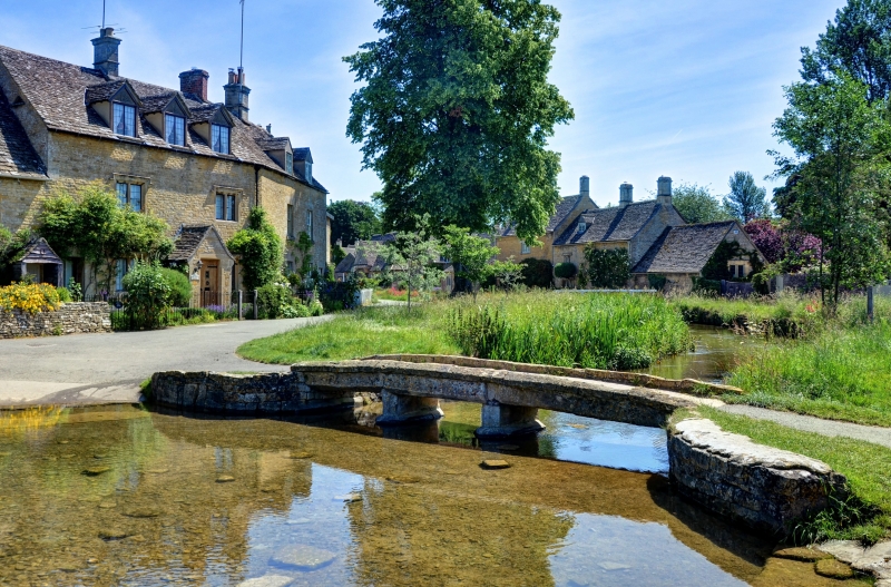
Entry Name: Up Stream Bridge
Listing Date: 25 August 1960
Grade: II
Source: Historic England
Source ID: 1154691
English Heritage Legacy ID: 129906
ID on this website: 101154691
Location: Lower Slaughter, Cotswold, Gloucestershire, GL54
County: Gloucestershire
District: Cotswold
Civil Parish: Lower Slaughter
Traditional County: Gloucestershire
Lieutenancy Area (Ceremonial County): Gloucestershire
Church of England Parish: Lower Slaughter St Mary
Church of England Diocese: Gloucester
Tagged with: Bridge
LOWER SLAUGHTER
SP 1622
10/22 Up-Stream Bridge
25.8.60
- II
Outside Vine House. C18 or C19. Footbridge of three spars made of large
freestone slabs with low parapet walls. Rather more than a clapper bridge.
s
Listing NGR: SP1636922543
External links are from the relevant listing authority and, where applicable, Wikidata. Wikidata IDs may be related buildings as well as this specific building. If you want to add or update a link, you will need to do so by editing the Wikidata entry.


Other nearby listed buildings
