Approximate Location Map
Large Map »
Latitude: 51.4028 / 51°24'9"N
Longitude: -1.173 / 1°10'22"W
OS Eastings: 457624
OS Northings: 167405
OS Grid: SU576674
Mapcode National: GBR 939.XZX
Mapcode Global: VHCZM.M07G
Plus Code: 9C3WCR3G+4R
Entry Name: Home Farm Cottage
Listing Date: 11 December 1979
Grade: II
Source: Historic England
Source ID: 1156082
English Heritage Legacy ID: 39681
ID on this website: 101156082
Location: Upper Woolhampton, West Berkshire, RG7
County: West Berkshire
Civil Parish: Woolhampton
Built-Up Area: Woolhampton
Traditional County: Berkshire
Lieutenancy Area (Ceremonial County): Berkshire
Church of England Parish: Woolhampton
Church of England Diocese: Oxford
Tagged with: Cottage
WOOLHAMPTON UPPER WOOLHAMPTON
SU 56 NE
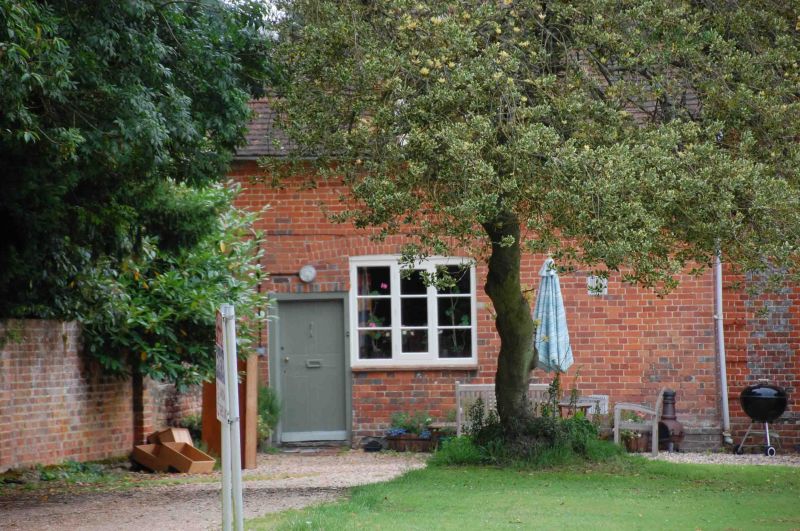
3/23 Home Farm Cottage
11.12.79
GV II
Cottage. C18. Red brick with old tile roof, hipped to left, gabled dormer
with casement and stack behind ridge to right. 1 1/2 storeys. One segmental
headed casement, with panelled door to left. Included for group value only.
Listing NGR: SU5762467405
External links are from the relevant listing authority and, where applicable, Wikidata. Wikidata IDs may be related buildings as well as this specific building. If you want to add or update a link, you will need to do so by editing the Wikidata entry.


Other nearby listed buildings
