Approximate Location Map
Large Map »
Latitude: 53.4079 / 53°24'28"N
Longitude: -0.8952 / 0°53'42"W
OS Eastings: 473538
OS Northings: 390689
OS Grid: SK735906
Mapcode National: GBR QY51.Z2
Mapcode Global: WHFFX.6LYS
Plus Code: 9C5XC453+5W
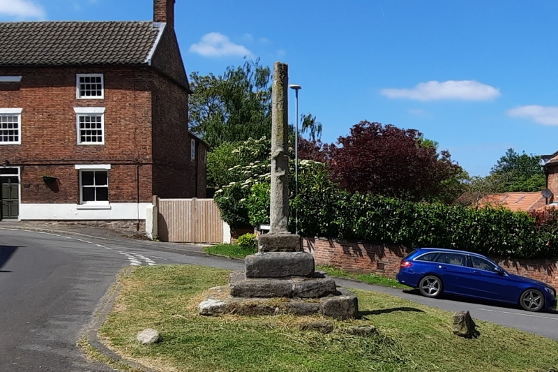
Entry Name: Gringley Village Cross
Listing Date: 28 February 1952
Grade: II
Source: Historic England
Source ID: 1156627
English Heritage Legacy ID: 241121
ID on this website: 101156627
Location: Gringley on the Hill, Bassetlaw, Nottinghamshire, DN10
County: Nottinghamshire
District: Bassetlaw
Civil Parish: Gringley on the Hill
Built-Up Area: Gringley on the Hill
Traditional County: Nottinghamshire
Lieutenancy Area (Ceremonial County): Nottinghamshire
Church of England Parish: Gringley-on-the-Hill
Church of England Diocese: Southwell and Nottingham
Tagged with: High cross
SK 79 SW GRINGLEY ON THE HILL CROSS HILL
5/39 Gringley Village
Cross
28.2.52
G.V. II
Village cross, C14, ashlar. Square plinth of 4 steps, square
base; broached octagonal shaft approx. 7' tall, with niche on
east side.
Listing NGR: SK7353890689
External links are from the relevant listing authority and, where applicable, Wikidata. Wikidata IDs may be related buildings as well as this specific building. If you want to add or update a link, you will need to do so by editing the Wikidata entry.


Other nearby listed buildings
