Approximate Location Map
Large Map »
Latitude: 53.243 / 53°14'34"N
Longitude: -1.7034 / 1°42'12"W
OS Eastings: 419891
OS Northings: 371811
OS Grid: SK198718
Mapcode National: GBR JZKY.06
Mapcode Global: WHCD0.TR17
Plus Code: 9C5W67VW+5J
Entry Name: Village Cross
Listing Date: 12 July 1967
Grade: II
Source: Historic England
Source ID: 1158480
English Heritage Legacy ID: 80937
ID on this website: 101158480
Location: Great Longstone, Derbyshire Dales, Derbyshire, DE45
County: Derbyshire
District: Derbyshire Dales
Civil Parish: Great Longstone
Built-Up Area: Great Longstone
Traditional County: Derbyshire
Lieutenancy Area (Ceremonial County): Derbyshire
Church of England Parish: Longstone St Giles
Church of England Diocese: Derby
Tagged with: High cross
SK 17 SE PARISH OF GREAT LONGSTONE MAIN STREET
3/24 (South Side)
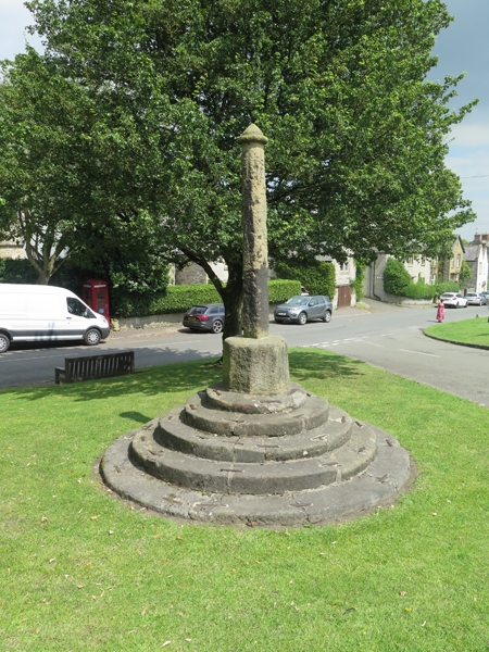
Village Cross
12.7.67 II
GV
Cross, probably C15. Gritstone. Five circular stone steps with iron ties linking
each stone. Octagonal base, square to octagonal shaft, much weathered, and circular
cap with pyramidal top.
Listing NGR: SK1989171811
External links are from the relevant listing authority and, where applicable, Wikidata. Wikidata IDs may be related buildings as well as this specific building. If you want to add or update a link, you will need to do so by editing the Wikidata entry.


Other nearby listed buildings
