Approximate Location Map
Large Map »
Latitude: 51.6128 / 51°36'46"N
Longitude: -0.5556 / 0°33'20"W
OS Eastings: 500109
OS Northings: 191431
OS Grid: TQ001914
Mapcode National: GBR F6X.Y1M
Mapcode Global: VHFSQ.BQ4H
Plus Code: 9C3XJC7V+4Q
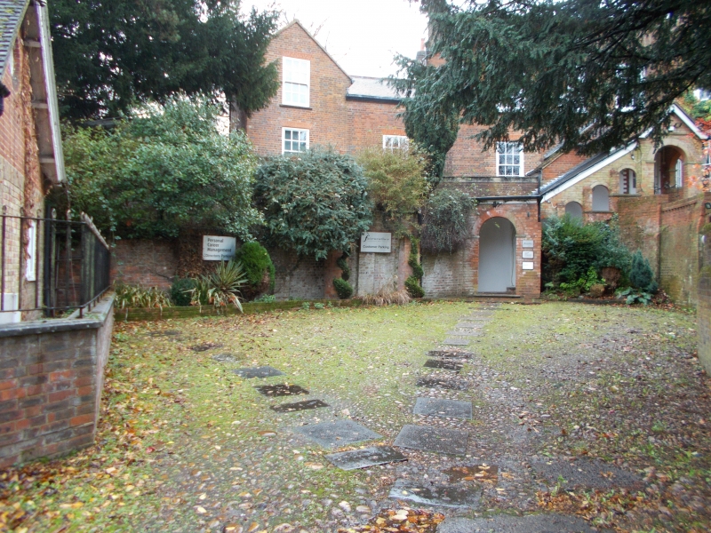
Entry Name: Hill House
Listing Date: 30 July 1984
Grade: II
Source: Historic England
Source ID: 1158508
English Heritage Legacy ID: 44783
ID on this website: 101158508
Location: Chalfont St Peter, Buckinghamshire, SL9
County: Buckinghamshire
Civil Parish: Chalfont St. Peter
Built-Up Area: Gerrards Cross
Traditional County: Buckinghamshire
Lieutenancy Area (Ceremonial County): Buckinghamshire
Church of England Parish: Chalfont St Peter
Church of England Diocese: Oxford
Tagged with: House
TQ 09 SW CHALFONT ST PETER GRAVEL HILL
6/37
Hill House
II
C18 with C19 additions. Red brick, hipped old tile roof with parapet and dentil
brick cornice. Two storeys, 1st floor stone band. Three double-hung sashes with
moulded frames, sills and flat arches. Five bay west front with full height canted
bay to bay 3, porch in bay 2.
Listing NGR: TQ0010991431
External links are from the relevant listing authority and, where applicable, Wikidata. Wikidata IDs may be related buildings as well as this specific building. If you want to add or update a link, you will need to do so by editing the Wikidata entry.


Other nearby listed buildings
