Approximate Location Map
Large Map »
Latitude: 52.4583 / 52°27'29"N
Longitude: 0.0467 / 0°2'48"E
OS Eastings: 539159
OS Northings: 286448
OS Grid: TL391864
Mapcode National: GBR L43.SQF
Mapcode Global: VHHHW.RGJV
Plus Code: 9F42F25W+8M
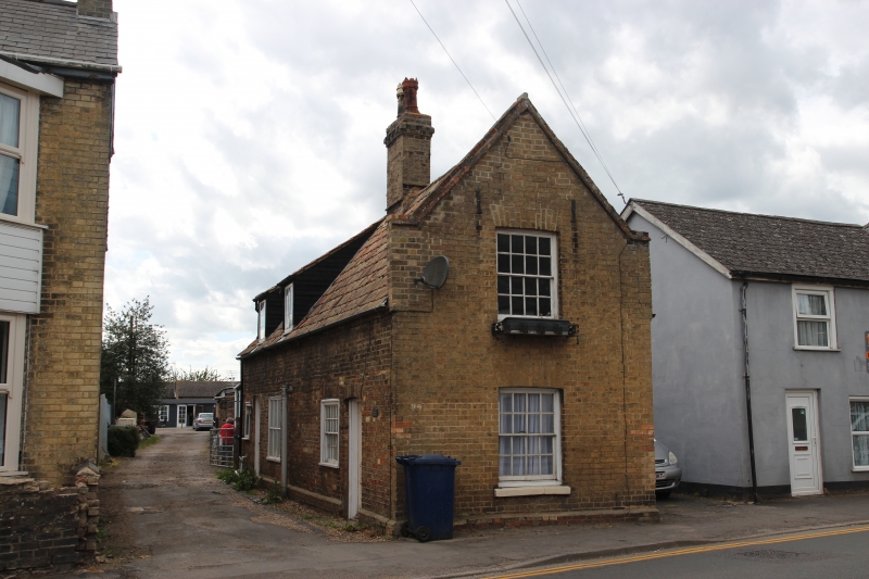
Entry Name: 94, High Street
Listing Date: 20 February 1980
Grade: II
Source: Historic England
Source ID: 1160869
English Heritage Legacy ID: 47993
ID on this website: 101160869
Location: Chatteris, Fenland, Cambridgeshire, PE16
County: Cambridgeshire
District: Fenland
Civil Parish: Chatteris
Built-Up Area: Chatteris
Traditional County: Cambridgeshire
Lieutenancy Area (Ceremonial County): Cambridgeshire
Church of England Parish: Chatteris St Peter and St Paul
Church of England Diocese: Ely
Tagged with: Building
HIGH STREET
1.
5139
No 94
TL 383852 7/36 20.2.80
II GV
2.
Late C18 row of cottages. Mainly red brick with early C19 gault brick gable end
to road. Pantiled roof of steep pitch with gable end parapets. Internal stack.
Listing NGR: TL3915986448
External links are from the relevant listing authority and, where applicable, Wikidata. Wikidata IDs may be related buildings as well as this specific building. If you want to add or update a link, you will need to do so by editing the Wikidata entry.


Other nearby listed buildings
