Approximate Location Map
Large Map »
Latitude: 50.2799 / 50°16'47"N
Longitude: -5.2565 / 5°15'23"W
OS Eastings: 168088
OS Northings: 47287
OS Grid: SW680472
Mapcode National: GBR Z1.ZG98
Mapcode Global: VH12B.T7Z8
Plus Code: 9C2P7PHV+XC
Entry Name: Chimney Stack on Clifftop at SW 680 472
Listing Date: 12 September 1989
Grade: II
Source: Historic England
Source ID: 1161466
English Heritage Legacy ID: 66785
ID on this website: 101161466
Location: Cornwall, TR16
County: Cornwall
Civil Parish: Portreath
Traditional County: Cornwall
Lieutenancy Area (Ceremonial County): Cornwall
Church of England Parish: Mount Hawke with Mithian
Church of England Diocese: Truro
Tagged with: Chimney
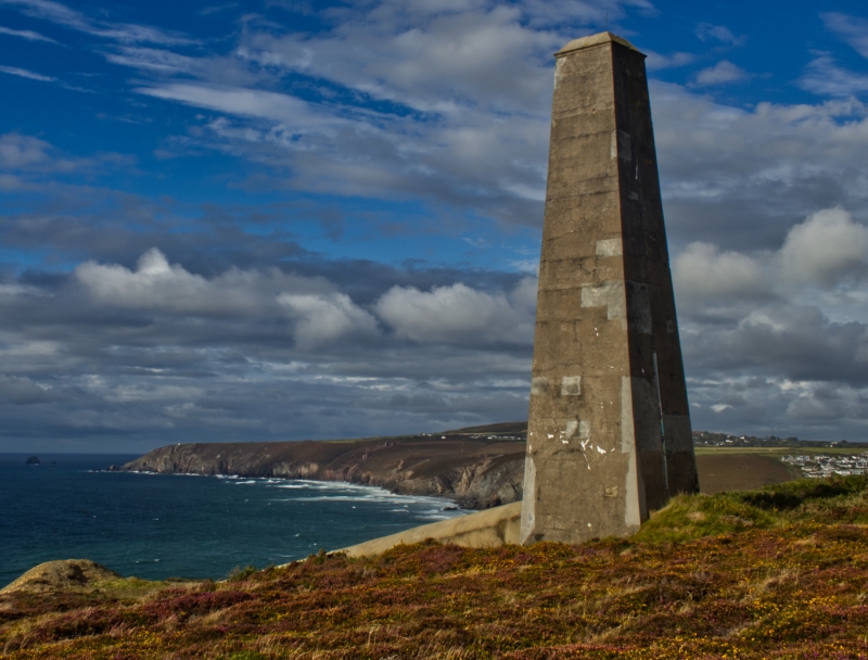
PORTREATH
SW 64 NE
1/229 Chimney stack on clifftop at
SW 680 472
II
Chimney stack. Probably late C19. Rendered course concrete. Square in section
and approx. 10 metres high, strongly tapered. Long sloped concrete flue at
ground level on north side (damaged). Probably associated with refining of
arsenic.
Listing NGR: SW6808847287
External links are from the relevant listing authority and, where applicable, Wikidata. Wikidata IDs may be related buildings as well as this specific building. If you want to add or update a link, you will need to do so by editing the Wikidata entry.


Other nearby listed buildings
