Approximate Location Map
Large Map »
Latitude: 50.2608 / 50°15'38"N
Longitude: -5.2849 / 5°17'5"W
OS Eastings: 165966
OS Northings: 45249
OS Grid: SW659452
Mapcode National: GBR Z0.PLSP
Mapcode Global: VH12B.BPXZ
Plus Code: 9C2P7P68+82
Entry Name: Milepost Opposite Methodist Church
Listing Date: 12 September 1989
Grade: II
Source: Historic England
Source ID: 1161478
English Heritage Legacy ID: 66791
ID on this website: 101161478
Location: Portreath, Cornwall, TR16
County: Cornwall
Civil Parish: Portreath
Built-Up Area: Portreath
Traditional County: Cornwall
Lieutenancy Area (Ceremonial County): Cornwall
Church of England Parish: Saint Illogan
Church of England Diocese: Truro
Tagged with: Milestone
PORTREATH PENBERTHY ROAD
SW 64 NE
(south side)
1/237
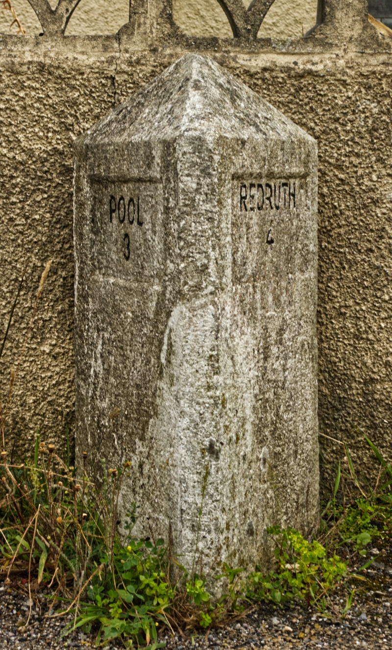
Milepost
opposite Methodist Church
II
Milepost. Probably later C19. Dressed granite. Triangular type, approx. one
metre high, with a sunk panel in each outer face, inscribed:-
POOL REDRUTH
3 4
Listing NGR: SW6596645248
External links are from the relevant listing authority and, where applicable, Wikidata. Wikidata IDs may be related buildings as well as this specific building. If you want to add or update a link, you will need to do so by editing the Wikidata entry.


Other nearby listed buildings
