Approximate Location Map
Large Map »
Latitude: 53.4058 / 53°24'20"N
Longitude: -2.5787 / 2°34'43"W
OS Eastings: 361626
OS Northings: 390038
OS Grid: SJ616900
Mapcode National: GBR BYF1.JV
Mapcode Global: WH98K.CN9F
Plus Code: 9C5VCC4C+8G
Entry Name: Orford Green Farmhouse
Listing Date: 4 April 1975
Grade: II
Source: Historic England
Source ID: 1161552
English Heritage Legacy ID: 58855
ID on this website: 101161552
Location: Warrington, Cheshire, WA2
County: Warrington
Electoral Ward/Division: Orford
Parish: Non Civil Parish
Built-Up Area: Warrington
Traditional County: Lancashire
Lieutenancy Area (Ceremonial County): Cheshire
Church of England Parish: Orford St Margaret
Church of England Diocese: Liverpool
Tagged with: Farmhouse
1. VALE OWEN ROAD
5150
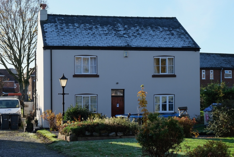
Orford Green Farmhouse
SJ 6190 3/133
II GV
2.
Early C19, scored stucco, new slate roof, 2 storeys. Studded door with fanlight
2 5-light sliding sash windows on each floor with keystones. End chimneys.
Orford Green Farmhouse, Barn to East and Nos I to 3 (consec) Farm Cottages
form a group.
Listing NGR: SJ6162690038
External links are from the relevant listing authority and, where applicable, Wikidata. Wikidata IDs may be related buildings as well as this specific building. If you want to add or update a link, you will need to do so by editing the Wikidata entry.


Other nearby listed buildings
