Approximate Location Map
Large Map »
Latitude: 52.2841 / 52°17'2"N
Longitude: -2.5144 / 2°30'52"W
OS Eastings: 365002
OS Northings: 265226
OS Grid: SO650652
Mapcode National: GBR BV.Y7P1
Mapcode Global: VH84M.CVKF
Plus Code: 9C4V7FMP+J6
Entry Name: Church of St Michael and All Angels
Listing Date: 27 February 1986
Grade: II
Source: Historic England
Source ID: 1167331
English Heritage Legacy ID: 149250
ID on this website: 101167331
Location: St Michael and All Angels' Church, Hanley Child, Malvern Hills, Worcestershire, WR15
County: Worcestershire
District: Malvern Hills
Civil Parish: Hanley
Traditional County: Worcestershire
Lieutenancy Area (Ceremonial County): Worcestershire
Church of England Parish: Teme Valley South
Church of England Diocese: Worcester
Tagged with: Church building
HANLEY CP HANLEY CHILD
SO 66 NW
4/57 Church of St Michael
5/57 and All Angels
GV II
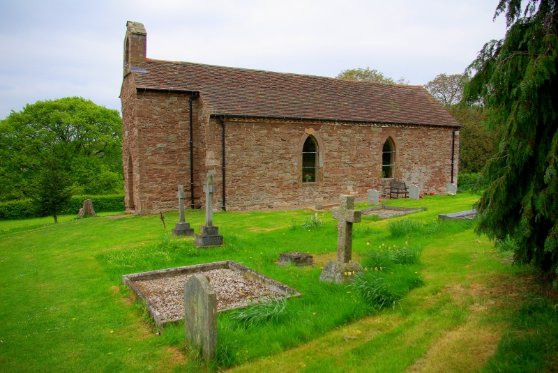
Parish church. Built in 1807 on site of older building, altered 1864.
Sandstone rubble and tufa with sandstone ashlar dressings, brick dentilled
eaves cornice and plain tiled roofs. Base of west tower and continuous
nave and chanel. Base of west tower was retained after upper part fell
down in 1864; it was gabled continuing the main ridge and given a gabled
bellcote pierced with a pointed-arched opening in which is hung the single
uninscribed bell; the base forms the entrance porch and has a pointed door-
way in its west elevation. Nave and chancel: two large lancets in south
elevation and one in north elevation, all with plain glazing; to east of
north window is a large raking buttress. Y-traceried window in east end
which has retained its original quarry-leaded glass. Interior: plastered
throughout; oak panelling with frieze at east end and north-west of nave.
Early C19 altar rails with turned balusters and fluted posts. Mid-C19
octagonal stone font with pointed-lobed quatrefoil decoration. A small
simple early C19 church situated in close proximity to Court Farmhouse (qv).
(VCH 4, p 271; BoE, p 188).
Listing NGR: SO6500265226
External links are from the relevant listing authority and, where applicable, Wikidata. Wikidata IDs may be related buildings as well as this specific building. If you want to add or update a link, you will need to do so by editing the Wikidata entry.


Other nearby listed buildings
