Approximate Location Map
Large Map »
Latitude: 51.0622 / 51°3'43"N
Longitude: -1.3153 / 1°18'55"W
OS Eastings: 448077
OS Northings: 129432
OS Grid: SU480294
Mapcode National: GBR 861.B8G
Mapcode Global: FRA 8649.TMM
Plus Code: 9C3W3M6M+VV
Entry Name: 11, the Square
Listing Date: 14 January 1974
Grade: II
Source: Historic England
Source ID: 1173990
English Heritage Legacy ID: 144850
ID on this website: 101173990
Location: Winchester, Hampshire, SO23
County: Hampshire
District: Winchester
Electoral Ward/Division: St Michael
Parish: Non Civil Parish
Built-Up Area: Winchester
Traditional County: Hampshire
Lieutenancy Area (Ceremonial County): Hampshire
Church of England Parish: Winchester St Lawrence with St Swithun-upon-Kingsgate
Church of England Diocese: Winchester
Tagged with: Building
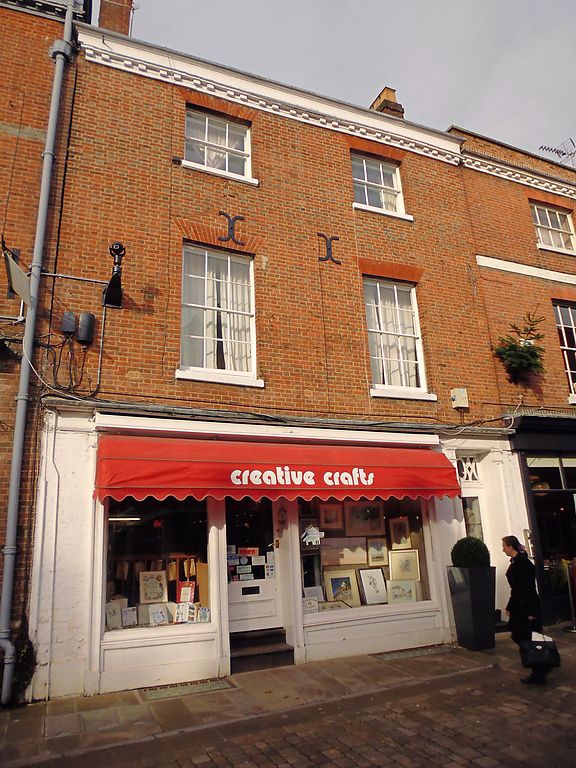
THE SQUARE
1.
1833
(North Side)
No 11
SU 4829 SW 6/259
II GV
2.
Late C18. Red brick. Three storeys, two windows, sashes with glazing
bars above a modern shop front. Parapet, tiled roof.
The listed buildings on the north side of The Square from No 10 to No
25 form a group.
Listing NGR: SU4807529431
External links are from the relevant listing authority and, where applicable, Wikidata. Wikidata IDs may be related buildings as well as this specific building. If you want to add or update a link, you will need to do so by editing the Wikidata entry.


Other nearby listed buildings
