Approximate Location Map
Large Map »
Latitude: 51.2092 / 51°12'33"N
Longitude: -2.3791 / 2°22'44"W
OS Eastings: 373610
OS Northings: 145625
OS Grid: ST736456
Mapcode National: GBR 0SL.59G
Mapcode Global: VH97C.QV3W
Plus Code: 9C3V6J5C+M8
Entry Name: Village Lock-Up
Listing Date: 27 November 1984
Grade: II
Source: Historic England
Source ID: 1174628
English Heritage Legacy ID: 266818
ID on this website: 101174628
Location: Nunney, Somerset, BA11
County: Somerset
District: Mendip
Civil Parish: Nunney
Built-Up Area: Nunney
Traditional County: Somerset
Lieutenancy Area (Ceremonial County): Somerset
Tagged with: Village lock-up
ST7345
12/119
NUNNEY CP
HORN STREET (East side)
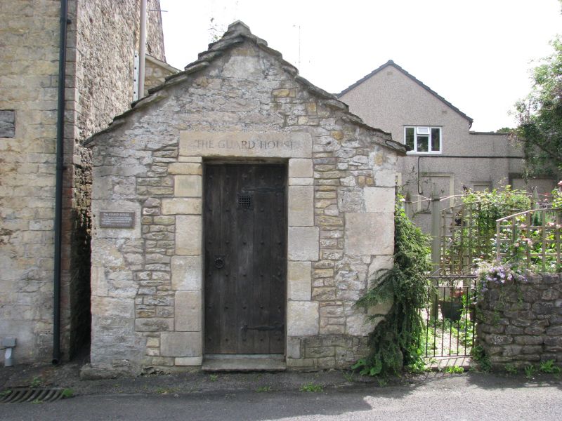
Village Lock-up
GV
II
Lock-up, now store. Circa 1700, altered C20. Doulting rubble, dressed quoins, stone slate roof. Rectangular. Single
storey; broad door opening to front, chamfered stone jambs, wooden lintel with further stone lintel above, double plank
doors. Included primarily for historic interest.
Listing NGR: ST7361045625
External links are from the relevant listing authority and, where applicable, Wikidata. Wikidata IDs may be related buildings as well as this specific building. If you want to add or update a link, you will need to do so by editing the Wikidata entry.


Other nearby listed buildings
