Approximate Location Map
Large Map »
Latitude: 52.4213 / 52°25'16"N
Longitude: -3.0255 / 3°1'31"W
OS Eastings: 330359
OS Northings: 280859
OS Grid: SO303808
Mapcode National: GBR B5.NFV7
Mapcode Global: VH769.HDXP
Plus Code: 9C4RCXCF+GR
Entry Name: Turnpike Cottage
Listing Date: 21 March 1968
Grade: II
Source: Historic England
Source ID: 1175693
English Heritage Legacy ID: 257232
ID on this website: 101175693
Location: Clun, Shropshire, SY7
County: Shropshire
Civil Parish: Clun
Built-Up Area: Clun
Traditional County: Shropshire
Lieutenancy Area (Ceremonial County): Shropshire
Church of England Parish: Clun
Church of England Diocese: Hereford
Tagged with: Cottage
SO 3080-3180 CLUN C.P. HIGH STREET
(South side)
15/143 No.1 (Turnpike
21.3.68 Cottage)
GV II
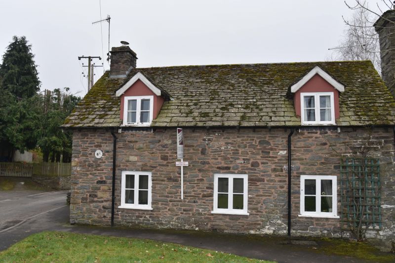
Cottage. Mid-C19 with C20 additions at rear. Coursed limestone
rubble with graded stone slate roof. One storey and attic. 2 gabled
eaves-dormers with 2-light casements, and integral stone end-stack to
left. 3-window front; 2-light wooden casements. One storey addition
to right with boarded door. Included for group value.
Listing NGR: SO3040980905
External links are from the relevant listing authority and, where applicable, Wikidata. Wikidata IDs may be related buildings as well as this specific building. If you want to add or update a link, you will need to do so by editing the Wikidata entry.


Other nearby listed buildings
