Approximate Location Map
Large Map »
Latitude: 52.5353 / 52°32'6"N
Longitude: -2.4193 / 2°25'9"W
OS Eastings: 371654
OS Northings: 293126
OS Grid: SO716931
Mapcode National: GBR BZ.F749
Mapcode Global: VH90Z.0JVT
Plus Code: 9C4VGHPJ+47
Entry Name: 51, High Street
Listing Date: 18 July 1949
Grade: II
Source: Historic England
Source ID: 1177609
English Heritage Legacy ID: 254447
ID on this website: 101177609
Location: Bridgnorth, Shropshire, WV16
County: Shropshire
Civil Parish: Bridgnorth
Built-Up Area: Bridgnorth
Traditional County: Shropshire
Lieutenancy Area (Ceremonial County): Shropshire
Church of England Parish: Bridgnorth
Church of England Diocese: Hereford
Tagged with: Building
1.
1954 BRIDGNORTH
HIGH STREET
(East Side)
No 51
SO 79 SW 2/110 18.7.49.
II GV
2.
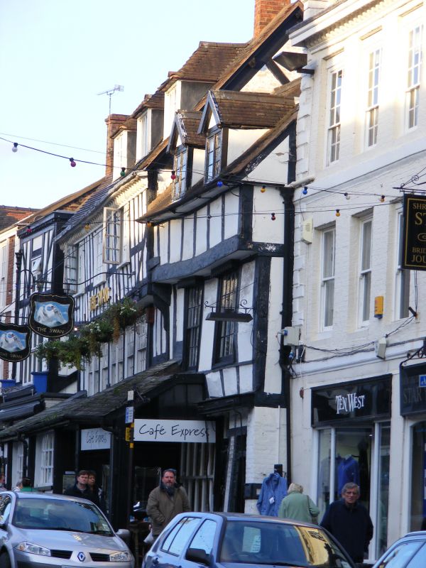
Early C17 post and pan timber frame and plaster; 2 storeys, the upper
overhanging; 2 early C19 sash windows; 2 restored gabled dormers; tiles.
Old open shop with slated pentice roof continued over adjoining Swan
Inn.
Nos 50 and 51. Swan Inn and Nos 53 to 57 (consec) form a group
Listing NGR: SO7165493126
External links are from the relevant listing authority and, where applicable, Wikidata. Wikidata IDs may be related buildings as well as this specific building. If you want to add or update a link, you will need to do so by editing the Wikidata entry.


Other nearby listed buildings
