Approximate Location Map
Large Map »
Latitude: 52.516 / 52°30'57"N
Longitude: -2.3855 / 2°23'7"W
OS Eastings: 373939
OS Northings: 290971
OS Grid: SO739909
Mapcode National: GBR 08Q.9Q6
Mapcode Global: VH915.L1R2
Plus Code: 9C4VGJ87+9R
Entry Name: The Chantry
Listing Date: 1 February 1974
Grade: II
Source: Historic England
Source ID: 1177870
English Heritage Legacy ID: 254496
ID on this website: 101177870
Location: Quatford, Shropshire, WV15
County: Shropshire
Civil Parish: Bridgnorth
Traditional County: Shropshire
Lieutenancy Area (Ceremonial County): Shropshire
Church of England Parish: Quatford
Church of England Diocese: Hereford
Tagged with: Architectural structure
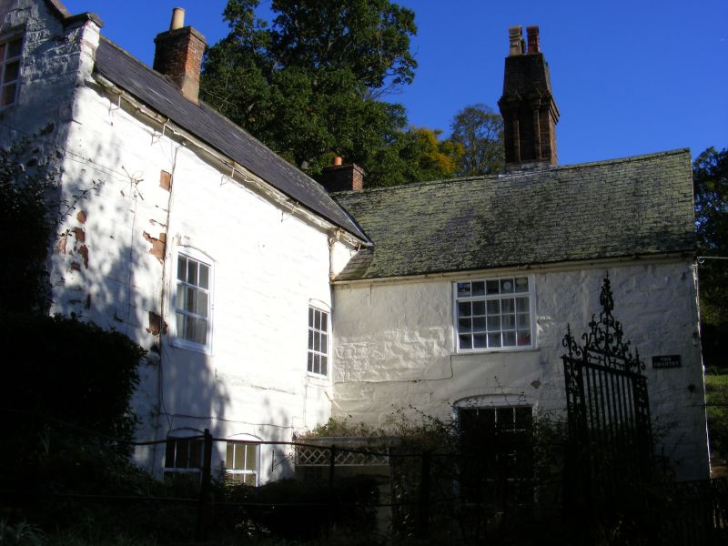
1.
1954 BRIDGNORTH
QUATFORD VILLAGE
The Chantry
SO 79 SW 22/263
II
2.
A simple cottage probably early C18, the core C15, with later wing at
right-angles. Local red sandstone; 2 storeys; early C19 doorcase and
casement windows; stringcourse; defaced coved eaves; later brick stacks;
slates. An internal C15 piscina appears to be in situ and the original
building was probably a small chantry chapel of this period.
Listing NGR: SO7393990971
External links are from the relevant listing authority and, where applicable, Wikidata. Wikidata IDs may be related buildings as well as this specific building. If you want to add or update a link, you will need to do so by editing the Wikidata entry.


Other nearby listed buildings
