Approximate Location Map
Large Map »
Latitude: 52.516 / 52°30'57"N
Longitude: -2.3863 / 2°23'10"W
OS Eastings: 373880
OS Northings: 290969
OS Grid: SO738909
Mapcode National: GBR 08Q.9HN
Mapcode Global: VH915.L192
Plus Code: 9C4VGJ87+9F
Entry Name: Chantry Cottage
Listing Date: 1 February 1974
Grade: II
Source: Historic England
Source ID: 1177878
English Heritage Legacy ID: 254498
ID on this website: 101177878
Location: Quatford, Shropshire, WV15
County: Shropshire
Civil Parish: Bridgnorth
Traditional County: Shropshire
Lieutenancy Area (Ceremonial County): Shropshire
Church of England Parish: Quatford
Church of England Diocese: Hereford
Tagged with: Cottage
1.
1954 BRIDGNORTH
QUATFORD VILLAGE
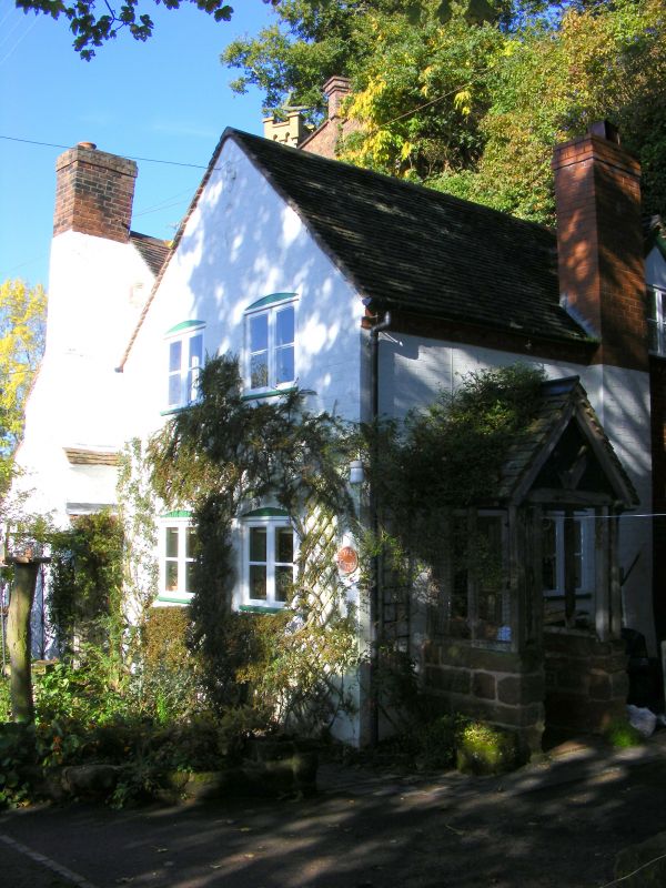
Chantry Cottage
SO 79 SW 22/265
II
2.
C17-C18. A 2-storeyed cottage of sandstone and brick, with protruding
chimney-breast towards wood, having three tiled offsets. Casement windows;
tiles. Built against rock face and having larder etc. quarried into it.
Listing NGR: SO7388090969
External links are from the relevant listing authority and, where applicable, Wikidata. Wikidata IDs may be related buildings as well as this specific building. If you want to add or update a link, you will need to do so by editing the Wikidata entry.


Other nearby listed buildings
