Approximate Location Map
Large Map »
Latitude: 51.1485 / 51°8'54"N
Longitude: -0.9762 / 0°58'34"W
OS Eastings: 471705
OS Northings: 139297
OS Grid: SU717392
Mapcode National: GBR C9B.S0W
Mapcode Global: VHDYC.1D8F
Plus Code: 9C3X42XF+9G
Entry Name: 54 and 56, High Street
Listing Date: 31 March 1977
Grade: II
Source: Historic England
Source ID: 1179806
English Heritage Legacy ID: 141810
ID on this website: 101179806
Location: Alton, East Hampshire, GU34
County: Hampshire
District: East Hampshire
Civil Parish: Alton
Built-Up Area: Alton
Traditional County: Hampshire
Lieutenancy Area (Ceremonial County): Hampshire
Church of England Parish: The Resurrection Alton
Church of England Diocese: Winchester
Tagged with: Building
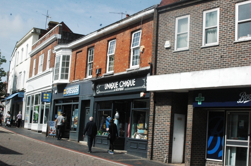
HIGH STREET
1.
5236
(North West Side)
Nos 54 and 56
SU 7139 2/92
II
2.
Early C19. 2 storeys. Brick. Ground floor with modern shop fronts. Moulded
wood eaves cornice. No 54: 2 bays wide. 1st floor with 2 recessed sash windows
with glazing bars. No 56: 3 bays wide. 1st floor with a canted bay window,
a blank window and a recessed sash window with glazing bars.
Listing NGR: SU7170239294
External links are from the relevant listing authority and, where applicable, Wikidata. Wikidata IDs may be related buildings as well as this specific building. If you want to add or update a link, you will need to do so by editing the Wikidata entry.


Other nearby listed buildings
