Approximate Location Map
Large Map »
Latitude: 52.2054 / 52°12'19"N
Longitude: -2.1397 / 2°8'23"W
OS Eastings: 390546
OS Northings: 256360
OS Grid: SO905563
Mapcode National: GBR 1G1.RTX
Mapcode Global: VH92N.VTNQ
Plus Code: 9C4V6V46+54
Entry Name: Ravenshill Farmhouse
Listing Date: 29 December 1952
Grade: II
Source: Historic England
Source ID: 1180013
English Heritage Legacy ID: 147891
ID on this website: 101180013
Location: Moor End, Wychavon, Worcestershire, WR9
County: Worcestershire
District: Wychavon
Civil Parish: Tibberton
Traditional County: Worcestershire
Lieutenancy Area (Ceremonial County): Worcestershire
Church of England Parish: Hadzor with Oddingley and Tibberton
Church of England Diocese: Worcester
Tagged with: Farmhouse
TIBBERTON CP PLOUGH ROAD (east side)
SO 95 NW
6/215 (22/8) Ravenshill Farmhouse
29.12.52
GV II
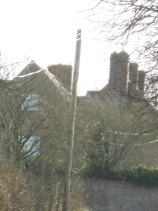
Farmhouse. Late C17 rebuilding of older structure, extended early C18
with mid-C19 alterations. Handmade brick on lias limestone rubble base;
two-span plain tiled roofs. Two parallel three-bay ranges aligned north/
south, external chimneys with off-sets at gable ends except for north-east
end. Two storeys, attic with dormers and cellar; 3-course band between
main storeys of east range; dentilled eaves cornice to west range. West
entrance elevation: windows are C19 casements with cambered heads; 3-light
windows in outer bays and 2-light windows in central bay; main entrance
to right of left bay has a gabled canopy on shaped brackets and a C19 door.
Brick ridge stack to left of centre. Interior: moulded ceiling beams, most
of original oak doors and floors retained; the two first-floor rooms of the
east range have C17 oak-panelled fireplaces with cornices; above the fire-
place in the southern room, behind the wallpaper, is reported to be a
painting on canvas of Europa and the bull. A lias limestone rubble wall
divides the two ranges. The earlier east range has two gables with case-
ment windows; this was originally the front elevation of the C17 house.
The cellar lies beneath the later west range and was probably the cellar
of an earlier structure on the site. Said to be among the earliest complete
brick structures in the County. (VCH 3 (ii), p 537).
Listing NGR: SO9054656360
External links are from the relevant listing authority and, where applicable, Wikidata. Wikidata IDs may be related buildings as well as this specific building. If you want to add or update a link, you will need to do so by editing the Wikidata entry.


Other nearby listed buildings
