Approximate Location Map
Large Map »
Latitude: 50.8888 / 50°53'19"N
Longitude: -0.3295 / 0°19'46"W
OS Eastings: 517594
OS Northings: 111254
OS Grid: TQ175112
Mapcode National: GBR HLS.7HC
Mapcode Global: FRA B66R.FGH
Plus Code: 9C2XVMQC+G6
Entry Name: 64, High Street
Listing Date: 9 May 1980
Grade: II
Source: Historic England
Source ID: 1180406
English Heritage Legacy ID: 298707
ID on this website: 101180406
Location: Steyning, Horsham, West Sussex, BN44
County: West Sussex
District: Horsham
Civil Parish: Steyning
Built-Up Area: Steyning
Traditional County: Sussex
Lieutenancy Area (Ceremonial County): West Sussex
Church of England Parish: Steyning St Andrew
Church of England Diocese: Chichester
Tagged with: Building
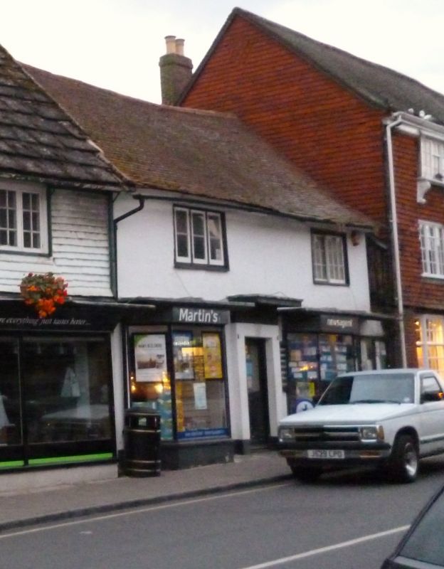
STEYNING HIGH STREET
1. (north-east side)
5404
No 64
TQ 1711 24/102
II GV
2.
Medieval timber-framed building with plastered front. Two storeys. Two windows.
Tiled roof. Modern shop front. One casement window and one horizontally-sliding
sash window above.
Listing NGR: TQ1759411254
External links are from the relevant listing authority and, where applicable, Wikidata. Wikidata IDs may be related buildings as well as this specific building. If you want to add or update a link, you will need to do so by editing the Wikidata entry.


Other nearby listed buildings
