Approximate Location Map
Large Map »
Latitude: 51.7015 / 51°42'5"N
Longitude: -1.5171 / 1°31'1"W
OS Eastings: 433465
OS Northings: 200420
OS Grid: SP334004
Mapcode National: GBR 6WQ.784
Mapcode Global: VHC0F.NH9G
Plus Code: 9C3WPF2M+J4
Entry Name: Tadpole Bridge and Flanking Walls
Listing Date: 15 January 1986
Grade: II
Source: Historic England
Source ID: 1181619
English Heritage Legacy ID: 250854
ID on this website: 101181619
Location: Buckland Marsh, Vale of White Horse, Oxfordshire, SN7
County: Oxfordshire
District: Vale of White Horse
Civil Parish: Buckland
Traditional County: Berkshire
Lieutenancy Area (Ceremonial County): Oxfordshire
Church of England Parish: Gainfield
Church of England Diocese: Oxford
Tagged with: Road bridge
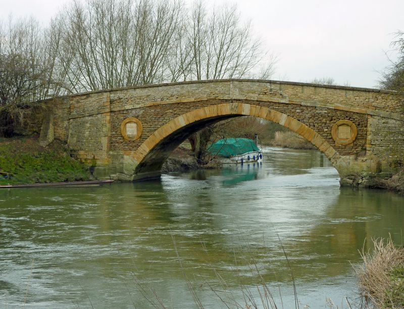
BUCKLAND
SP30SW
1/26 Tadpole Bridge and flanking
walls
GV II
Bridge. c.1780. Coursed limestone rubble with limestone ashlar dressings.
Broached pilaster buttresses flank arch; blind lunettes to spandrels; ashlar
string course beneath parapet.
Listing NGR: SP3346500420
External links are from the relevant listing authority and, where applicable, Wikidata. Wikidata IDs may be related buildings as well as this specific building. If you want to add or update a link, you will need to do so by editing the Wikidata entry.


Other nearby listed buildings
