Approximate Location Map
Large Map »
Latitude: 51.4867 / 51°29'12"N
Longitude: -1.8493 / 1°50'57"W
OS Eastings: 410558
OS Northings: 176430
OS Grid: SU105764
Mapcode National: GBR 3TT.M9M
Mapcode Global: VHB3R.WWPN
Plus Code: 9C3WF5P2+M7
Entry Name: 2
Listing Date: 2 September 1986
Grade: II
Source: Historic England
Source ID: 1182194
English Heritage Legacy ID: 311282
ID on this website: 101182194
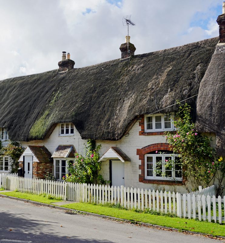
SU 17 NW BROAD HINTON VILLAGE CENTRE
SU 17 NW (south end)
2/12 No 2
GV II
Cottage in row. C18-C19. Painted chalkstone, thatched roof.
Single storey and attic, 3 bays. Central boarded door and 6-
panelled door in brick porch at left end. Canted bay and 4-light
casement windows to ground floor. Thatch swept over 2 flush
dormers to upper floor. Stack to left of central entrance.
Listing NGR: SU1055876430
External links are from the relevant listing authority and, where applicable, Wikidata. Wikidata IDs may be related buildings as well as this specific building. If you want to add or update a link, you will need to do so by editing the Wikidata entry.


Other nearby listed buildings
